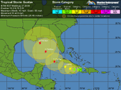
Gustav is currently a very small storm, similar in size to Hurricane Andrew of 1992. Tropical storm force winds extend out only 50 miles from the center. NHC is forecasting that Gustav will remain small over the next three days, with tropical storm-force winds expanding out only to a 75 miles radius.
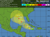
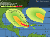
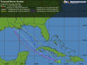
Gustav's impact on Cuba and Mexico's Cancun/Cozumel region
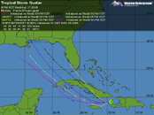
If you're in the cone of uncertainty, you're at risk. Hurricane forecasts are uncertain, and this uncertainty is graphically represented by the cone of uncertainty around the central "best guess" forecast positions. Cancun and Cozumel are both in the cone of uncertainty, so could get a direct hit from Gustav. At present, though, it appears that Mexico's Yucatan will only have one day of heavy rain (Saturday) with some winds gusts of 40-50 mph. The odds of Cozumel getting sustained winds of tropical storm force (39 mph or greater) are not much higher, though, and have increased to 29%, as indicated in NHC's wind probability product. The odds of hurricane force winds are 6%.
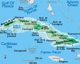
The portion of the world most likely to suffer a major hurricane strike from Gustav will be western Cuba. If Gustav makes landfall as a major hurricane somewhere along this stretch of coast, it may bring a storm surge of 10-15 feet to the right of where the eye come ashore.