Keep an eye on this one

Please register or login

Welcome to ScubaBoard, the world's largest scuba diving community. Registration is not required to read the forums, but we encourage you to join. Joining has its benefits and enables you to participate in the discussions.

Benefits of registering include

  • Ability to post and comment on topics and discussions.
  • A Free photo gallery to share your dive photos with the world.
  • You can make this box go away

Joining is quick and easy. Log in or Register now!

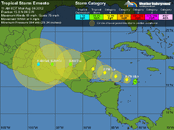
This storm is weakening, not strengthening as it brushes land in Central America all the way to the Yucatan. All of the models are getting closer to agreement and Cozumel is not even in the cone anymore so it will be really unlikely for this to be any threat to us at all other than some typical scattered thunderstorms. Happy for our neighbors to the south that is is coming in as a tropical storm.

As far as the NW quadrant being the dirty side, true, but still - the worst part is closer in towards the eye. The further out you get, the less impact there is.
 
Looking at the latest projections if it would graze the landmass down by Honduras and Nicaragua it would seem like it would weaken it and/or at least take some more of the punch out of it for where ever the main storm it hits land. On the plus side, they would only be taking the weakest part of the winds and storm being on the south/southeast side.

Looks like it might be diving a bit to the south. But I'm just speculating.


Larger view.. Click Here


storm-11.jpg
 
Last Aug I was in Roatan... After a week of diving I went over to the mainland to stay at Pico Bonito... That is when Harvey went by... The wind and rain was awesome! Looks like Ernesto will just miss Cozumel while I am down there... Two close misses is enough to make me consider avoiding the Caribbean during Aug...

---------- Post Merged at 04:13 PM ---------- Previous Post was at 04:00 PM ----------

At what range of wind speeds does the Cozumel Harbor master close the port? I think I may arrange some cenotes dives earlier in the trip just in case...
 
Last edited:
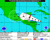
Not so fast.. The models this morning show it moved straight north and it also looks like it could come closer to CZM now than my post from above that showed it staying a TS. Also, even though it is only a prediction it shows it bumped back up to a Cat-1 hurricane from previously being a TS all the way across Mexico.

If it was to bump just a bit further north in the next day or so (not counting the two models that show it going way north) it could get very close to Cozumel.

I'm just saying...:no:

Larger view.. Click Here

storm-12a.jpg
 
Yeah, the Zone of Hate reaches as far as Tulum now, and who knows what will really happen. It's not over 'til it's over.
 
Chris, What are you talking about? We are still completely out of the cone according to the map you posted as well as this one and the official hurricane center map as well -
at201205_5day.gif

---------- Post Merged at 11:23 AM ---------- Previous Post was at 11:21 AM ----------

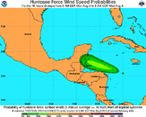
145218W5_NL_sm.gif

---------- Post Merged at 11:27 AM ---------- Previous Post was at 11:21 AM ----------

145218.gif

---------- Post Merged at 11:28 AM ---------- Previous Post was at 11:21 AM ----------

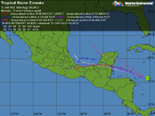
at201205_model.gif
 
There is currently one model that says he could land on Tulum tomorrow, and as much as things change - even more is possible. Most of the models seem to agree on Ambergis Cay tho...

at201205_model_zoom.gif
 
That's only one of several models, all others which are in agreement. But even then, the most we would get out of it won't even be tropical storm winds - wind yes, but not strong - just a windy day.
 
That's only one of several models, all others which are in agreement. But even then, the most we would get out of it won't even be tropical storm winds - wind yes, but not strong - just a windy day.

All I was saying is that it popped straight north last night (like an immediate right turn) and according to the map I posted it will gain strength again from a TS to Cat-1. Given what happened last night I just pointed out that there are two models that take it right over CZM and up into the Gulf.

Believe me I'm hoping it stays away, my bags are packed and sitting at the door just waiting for Saturday morning.
 
That's only one of several models, all others which are in agreement. But even then, the most we would get out of it won't even be tropical storm winds - wind yes, but not strong - just a windy day.
That's about what I said: 1 for Tulum, the rest for AC. But then..

You never know about these storms---ask me about Rita...she kicked us a new butthole here in SW La)...Being around them since 1958---Hurricane Audrey-- I can tell you you'll know where she/he's heading when they 'touchdown'.....Good luck to whomever 'gets him'.......

Rita--@ 8AM local time on a Thursday, I left for work with Rita heading 'into Houston'. Got home @ about 11:30 AM that same day & the wife was watching the latest prediction of her---now heading straight up our gonads..& yes, the next day, Friday, she made landfall @ about 4 PM..Us being ~80 miles inland 'got it' by 10 PM Friday nite...It 'stayed' around till about 6 AM Saturday......We had sustained winds registered @ our airport(about 1 mile from our house) of 90 MPH with gusts to 120---& something like over 150 tornadoes were spawned off of it.....
Time will tell. I guess if he took a surprise turn north, y'all could be ready for him by tomorrow night.
 

Back
Top Bottom