- Messages
- 7,659
- Reaction score
- 4,720
- # of dives
- 200 - 499
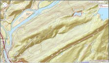
I'm going with a bottom profile map (done from the surface) so I don't waste my limited gas. Fun winter project.
Looking for a good folding, or inflatable boat. This is my current favorite, but it is stupidly expensive: https://alpackarafts.com/product/yukon-yak/. Five pounds, 8" diameter by 2' when rolled up.
Anybody able to suggest a cheaper alternative. The bottom has to be durable, there are a lot of rocks and tree limbs just below the surface.
---------- Post added November 27th, 2015 at 04:10 PM ----------
@knotsmart:
Just found this: https://vimeo.com/112640615. That should help put things into perspective. We are talking about a calm little pond at the top of a mountain.
Now, as one who has rafted the Cheat, New, and Gauley in a ducky, that is one badass little watercraft in the vid! I was once in a standard raft (Allegheny Wildwaters, IIRC, Beckley, W. Va.) that was the only craft able to make headway and hang against a rock to watch all the others navigate the one class VI rapid on the Gauley. Female guide.
We are talking about a pond and a hike here...


