Hurrcane Ida

Please register or login

Welcome to ScubaBoard, the world's largest scuba diving community. Registration is not required to read the forums, but we encourage you to join. Joining has its benefits and enables you to participate in the discussions.

Benefits of registering include

  • Ability to post and comment on topics and discussions.
  • A Free photo gallery to share your dive photos with the world.
  • You can make this box go away

Joining is quick and easy. Log in or Register now!

Yeah the stronger possibilities for wind on Coz are in 30+ hours, and that will probly be more on the east side. Hope so. Personally, I'd rather sit out the winds there than in Seattle.

If the winds hold strong Monday morning, it may even be difficult to get across to PDC for Cenotes or Ruins, but maybe diving will go well Monday afternoon? Or the island could break the winds enough that larger boats get out Monday morning. Who knows until then...?
 
I just Hope Mexicana will fly into Cancun Saturday afternoon. Will bring a bucket for the wife on the ferry ride to Coz.
I hope you got across before they shut them down at 4pm. That surprised me. What are they going to do with the boats Sunday? Sail them to Tampico...? :confused:

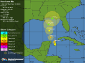
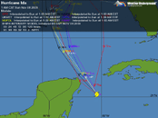
It currently looks like she is veering further east and more away from Coz and even Cancun which had been closer to the anticipated zone. Cuba may get more than I had thot. Edit: Now Cat-1 and anticipated to make Cat-2...!

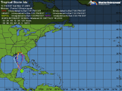
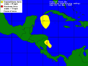
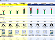
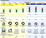
Ida.gif Ida 2.gif ida 3.gif Ida 4.gif
The current weather forecasts just don't look that bad for Sunday; a little windier during the wee hours Monday - put away outdoor furniture and drying gear, but dying by noon...

Ida 5.gif Ida 6.gif
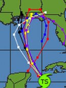
Amazingly, many of the models think it will last to hit the Florida panhandle and turn around, with bringing it back to the Yucatan Peninsula in time - but that's very long range guess work with a lot of chances of changes...

Ida 7.jpg Edit - updated: Ida 8.gif
 
Last edited:
Man that GFS model is wacky! Up through AL/MS and back to the Yucatan Channel.

IDA110809.gif


Jason
 
As of 6:30am Sunday - "norte" like winds in (30-40mph range)with gusts and not raining currently. Sky to the East is very dark and black, sky to the south has normal cloud formations with bits of sky poking through. No power loss, no internet or phone loss. By looking at the live satellite feed, looks like the worst is over for our isla! We shall see.

Was a calm night, with isolated rain and "norte" like winds.
 
Glad to hear, since it is blowing something crazy out here in Miami. Just don't know if the cruise ships will change their itineraries to the eastern Caribbean?
 
Glad to hear, since it is blowing something crazy out here in Miami. Just don't know if the cruise ships will change their itineraries to the eastern Caribbean?

I will second that. The winds here in the Keys have been a consistent 30mph. Just ask my coconut palm
 
It's pretty calm & quiet in Cozumel. Bright overcast but no rain in the northern part of town. Plenty of cars & motos moving around, storm shutters opened, outdoor furniture & potted plants put back in their proper places. Stiff breeze/light wind. Ocean looks unfriendly from a block away, tho. Haven't been down to the malecon today to know if waves are crashing or water's flowing over the seawall.
 
Highest wind i recorded last night was a ripping 21 MPH.
 
Man that GFS model is wacky! Up through AL/MS and back to the Yucatan Channel.
Yeah they did. Most of the models show it hitting Florida Panhandle as Cat-1 now, but just turning east - subject to change of course.
As of 6:30am Sunday - "norte" like winds in (30-40mph range)with gusts and not raining currently. Sky to the East is very dark and black, sky to the south has normal cloud formations with bits of sky poking through. No power loss, no internet or phone loss. By looking at the live satellite feed, looks like the worst is over for our isla! We shall see.

Was a calm night, with isolated rain and "norte" like winds.
Wow?! It did get that wild huh?
It's pretty calm & quiet in Cozumel. Bright overcast but no rain in the northern part of town. Plenty of cars & motos moving around, storm shutters opened, outdoor furniture & potted plants put back in their proper places. Stiff breeze/light wind. Ocean looks unfriendly from a block away, tho. Haven't been down to the malecon today to know if waves are crashing or water's flowing over the seawall.
Looks like y'all had a close call mostly, but lucked out. Cat-2 now up north of y'all.
Posted by: JeffMasters
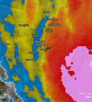
Hurricane Ida is threading the gap between Cuba and Mexico's Yucatan Peninsula as a Category 1 hurricane, and now appears poised to bring a punishing combination of high tides and heavy rain Monday night and Tuesday morning to the U.S. Gulf Coast. Ida is a compact hurricane, and radar imagery out of Cancun (Figure 1) reveals a tight inner core, with only limited rain bands affecting Mexico and western Cuba as the storm shoots through the Yucatan Channel. Top winds at Cancun, Mexico this morning have only been 15 mph, despite the fact that Ida is passing just 60 miles east of the city. Infrared and visible satellite loops show little change to Ida's heavy thunderstorm over the past six hours, and the hurricane appears to have changed little since the last Hurricane Hunter aircraft left at 6:30 am. A new Hurricane Hunter mission is scheduled for 1 pm EST this afternoon.
 
https://www.shearwater.com/products/swift/

Back
Top Bottom