Mapping assignment - any hints?

Please register or login

Welcome to ScubaBoard, the world's largest scuba diving community. Registration is not required to read the forums, but we encourage you to join. Joining has its benefits and enables you to participate in the discussions.

Benefits of registering include

  • Ability to post and comment on topics and discussions.
  • A Free photo gallery to share your dive photos with the world.
  • You can make this box go away

Joining is quick and easy. Log in or Register now!

The Mushroom King

Contributor
Scuba Instructor
Divemaster
Messages
223
Reaction score
0
Location
Tokyo
# of dives
100 - 199
I'm almost finished all the stuff for my DM, although there are a few areas I will likely do over or practise a bit more, but the one major task yet to complete is the mapping of a dive site.
other than what it said in the manual, does anyone have any good tips or suggestions for doing the mapping exercise?

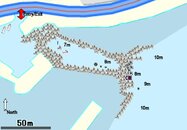
I was thinking of using my wet notes, so I can jot down stuff while on the dive. And I'm a bit concerned on calculating distances... would using a reel to measure be overkill?

If any one can toss in some helpful advice, please do. thanks!
 
I think the books cover it pretty well...one thing I would add....you don't have to do it all in just one dive....:wink:

This map doesn't have to be perfect in scale, distance, etc...but it does need to be fairly representative of the site and try to nail the headings/depths to the various attractions. Come up with a circuit "tour" of it. Get close to the distances but not to the point of using a reel or tape measure.

Of course, if you want to take the time, perform multiple dives, take accurate measurements and sweat out drawing it to scale with headings, go for it...but you'll be making the task harder than it's intended to be. You're a DMC, not a cartographer.
 
I agree about the circuit tour- you'll probably be leading students around the local sites so you don't want to get lost and you want to have options, depending on their ability, tanks, SAC, exposure protection, etc. I have a few fun circuits at the quarry that have a shallow option so that if the students get cold or have high SAC rates, we can return above the thermocline, in shallow water, and still see some things.

I went to the local quarry and ran lines between a few of the objects. I noted the depths and directions. I also noted landmarks along the way- I can pretty much navigate without a compass now. I then used a line and swam a 30' circle around the object so I could see what was a around the attraction and in which direction, so that if I got close or overshot, I would know which way to go (the vis is sometimes poor).
 
Thanks guys, thats a great idea about adding in a circuit tour to the map.
Planning on heading out either this sat or sunday and try to finish it.
 
Post it here if you can. :D
 
I did the bottom contour of one of our local dive sites. It took me something like 5 dives, if I remember correctly, to get all the information. The mapping project was one of my favorite parts of the class. :)

bluehole-3d-2.PNG


bluehole_2d-1.gif
 
Well here is my map from round one. Unfortunately the conditions were against us with visibility at about 2 meters. I'm not very happy with the results as I was hoping to do more. Well, maybe next month I can get a few shore dives at that location and improve upon it. The dive op doesn't have a good map of the shore point, so I'd like to give them a copy at some point.

BTW, the little grey thingies are concrete tetrapods - thats unfortunately what most of the shoreline looks like around here.
 

Attachments

  • yokoiso 2.jpg
    yokoiso 2.jpg
    41.5 KB · Views: 176
When I did mine I used a slate and wrote down all the headings/distances/depths so that I had all the information I needed from one dive. A tape will work fine but arm spans are nearly as accurate and fin kicks will get you within a few feet. How many to a 100 feet and you've got a pretty good rule of thumb. Then it's just a matter of putting all of ot on dry paper.
 
I'm sort of anal on these things, but when I did mine, I taped it.

the K
 
Guys, those are some nice maps! Great work!
 

Back
Top Bottom