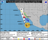
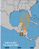
The tropics are waking up

Please register or login

Welcome to ScubaBoard, the world's largest scuba diving community. Registration is not required to read the forums, but we encourage you to join. Joining has its benefits and enables you to participate in the discussions.

Benefits of registering include

  • Ability to post and comment on topics and discussions.
  • A Free photo gallery to share your dive photos with the world.
  • You can make this box go away

Joining is quick and easy. Log in or Register now!

Bad couple of days for a Socorro trip.
Why do you say that? If you are speaking of Socorro, NM, there are no storms approaching it and it's forecast to be 10 to 20 degrees cooler than Austin over the next 10 days. It sounds lovely.
 
Didn’t know there was a Socorro, NM. I was referring to Socorro, Mexico with Hilary approaching. Big storm!
 
Why do you say that? If you are speaking of Socorro, NM, there are no storms approaching it and it's forecast to be 10 to 20 degrees cooler than Austin over the next 10 days. It sounds lovely.
lol... why would anyone talk about concerns for hurricanes for far inland Socorro, NM? especially on a diving forum?
 
lol... why would anyone talk about concerns for hurricanes for far inland Socorro, NM? especially on a diving forum?
Upon further review...

Socorro Islands Facts...

Commonly known as the Socorro - they are located in the Tropical Eastern Pacific Ocean, approximately 250 miles south of Cabo San Lucas, Mexico, at the tip of the Baja peninsula. Socorro is just one of this group of islands which comprise of San Benedicto, Roca Partida and Clarion.
 

Attachments

  • Screenshot 2023-08-18 at 2.39.55 PM.png
    Screenshot 2023-08-18 at 2.39.55 PM.png
    593.5 KB · Views: 107
Bad couple of days for a Socorro trip.
From the Noaa web site, it looks like Hilary passed either directly over or very close to Socorro. Any reports?
 
New this morning:
 

Attachments

  • Screenshot 2023-08-24 at 7.44.53 AM.png
    Screenshot 2023-08-24 at 7.44.53 AM.png
    45.6 KB · Views: 95
New this morning:
I watched the projected animation on Windy and it shows a pacific side low basically fizzle out on the pacific side at the Honduras Nicaragua border while a separate low forms NE of Roatan and passing east of Cozumel late Saturday / early Sunday and not building any strong winds until in the gulf above the west end of Cuba.
Wind Guru (KPH)
1692890282721.png
 
Wind models have it stalling near Cozumel for a few days before moving North.

1693067929556.png


Port will probably close tomorrow afternoon, if not sooner, hopefully it will open again by Wednesday.
 
'Tis the season...


There's a red one pointed at the Caribbean; I would screenshoot and upload the image but we can't do that right now. My peeps in south Louisiana are watching this one closely as well; the high pressure heat dome has been pushing storms off to the east all season so far, but it's been weakening over the past week or so.
 
Back
Top Bottom