Texas Clipper Trip Report 5/17

Please register or login

Welcome to ScubaBoard, the world's largest scuba diving community. Registration is not required to read the forums, but we encourage you to join. Joining has its benefits and enables you to participate in the discussions.

Benefits of registering include

  • Ability to post and comment on topics and discussions.
  • A Free photo gallery to share your dive photos with the world.
  • You can make this box go away

Joining is quick and easy. Log in or Register now!

So lets hear your educated explanation to the brown river muck at various levels of the southern gulf coast water column.....the explanations expressed here all sound solid and since I have persl. witnessed it, I find these are solid viable answers that match what has been explained to me for years now....but we have not heard your twist on what causes the muck and were does it originate..?

First, the burden of proof is on the one making the allegation, in this case the assertion the poor South Texas viz is due to the Mississippi. All I did was ask for some hard data and people tend to get upset when they are challenged for references and cannot respond with them.

Second, nobody said the muck didn't exist. That you have witnessed it doesn't speak anything as to what caused it. I could speculate that the moon was created by UFOs but the fact that I can see the moon in the sky doesn't validate my speculation.

Third, if the "explanations" are so viable there should be some supporting documentation out there. Where is it? In fact, what little data is out there suggests flow gets no further than Aransas, still a long ways from South Padre.

But if I were to make a wild eyed guess (might as well, everybody else is doing it) I would say it's local runoff from the Rio Grande and other Mexican rivers down to Tampico. Check an atlas sometime and you'll see that there are a dozen or more rivers in this area. Do a search on diving along the eastern Mexican coast and you'll find that Veracruz (far south) has pretty good viz but Tampico starts to have South Texas like viz. Now maybe the Mississippi is reaching deep into Mexico as well but given that the known currents flow south to north my best is the source is Mexican rivers.
 
I was with the group on the Clipper dive and I can't add much to the report other than a couple of observations. I noticed when we crossed into the thermocline there was a visual inversion that blurred the water and you could see where the thermocline was because the visibility went down to nothing. I was diving with Brad and we decided after dropping to 85 once not to drop below the thermocline because of the temp and vis, I told Mack it was like diving Travis. I got to meet a great group and dive with a great buddy and make three challenging dives, great fun and By the way, where ever that current came from it was in a HURRY to get where it was going! :D
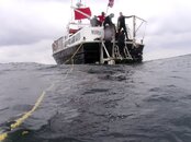
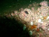
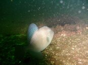
I am not much of a photographer and because of the muck in the current my pictures didn't turn out very good but here are a few.

Paul
Pict0003.jpg

Pict0002.jpg

3.jpg

Pict0004.jpg

Pict0015.jpg

Pict0024.jpg

Pict0025.jpg
 
Oh by the way I know the current was coming from the Mississippi because I was at the dive briefing and the CAPTAIN said so. JHHO :wink:
 
I am not impressed with the charters water entry procedure of sitting and handing your fins/mask to you....then helping you into your rig....I much prefer to handle all that on my own and not be sitting at the waters edge waiting for someone to hand me my own gear...not impressed.....I wonder how they handle their tech divers....hope not in this format!
 
But if I were to make a wild eyed guess (might as well, everybody else is doing it) I would say it's local runoff from the Rio Grande and other Mexican rivers down to Tampico. Check an atlas sometime and you'll see that there are a dozen or more rivers in this area. Do a search on diving along the eastern Mexican coast and you'll find that Veracruz (far south) has pretty good viz but Tampico starts to have South Texas like viz. Now maybe the Mississippi is reaching deep into Mexico as well but given that the known currents flow south to north my best is the source is Mexican rivers.

Provide us the proof and evidence of your ideas were this mud is from and we will all take it under consideration and review--- Bailiff!!
 
Paul,

Thanks for posting the pictures! It was great to meet and dive with you. When I get back from Japan, we will have to get together for another dive.

-Brad

I was with the group on the Clipper dive and I can't add much to the report other than a couple of observations. I noticed when we crossed into the thermocline there was a visual inversion that blurred the water and you could see where the thermocline was because the visibility went down to nothing. I was diving with Brad and we decided after dropping to 85 once not to drop below the thermocline because of the temp and vis, I told Mack it was like diving Travis. I got to meet a great group and dive with a great buddy and make three challenging dives, great fun and By the way, where ever that current came from it was in a HURRY to get where it was going! :D
I am not much of a photographer and because of the muck in the current my pictures didn't turn out very good but here are a few.

Paul
View attachment 45997

View attachment 45998

View attachment 45999

View attachment 46000

View attachment 46001

View attachment 46002

View attachment 46003
 
Hard Data? Well, it's no "smoking gun", but here's a bit of "circumstantial evidence".
On 5-16, buoy 42044 (just east of the southern tip of Texas), reported 1 m/sec current from nearly due north (NDBC - 5 Day Ocean Current Stick Plot at 42044). The next day, it was down to about .4 m/s, but it was still from the north. Now, this doesn't mean the silt was from the Mississippi, but it sure wasn't from the direction the earlier provided surface map indicated. What it does show is that currents are capricious in the Gulf (anyone who has dived the FG knows just how true that is).
As for the conditions being yucky "all the time", just about any resident will tell you that much of the time, the water off the Texas Coast is less than pristine...but they will also tell you that on occasion there will be days when beautiful, sparkling-clear Caribbean-like water extends all the way to the beaches. Again, the currents are fickle and can turn on a dime.
 
Thanks for the pics Paul. I'm glad some of us are using this thread for its intended purpose ie the trip. I tried to make a subtle hint earlier, however, some folks feel it is OK to hijack the thread for the purpose of a science debate.:shakehead:

Edit to add: Maybe I should start a new thread to discuss the mysteries of currents in the gulf. Then people could go in there and tell all their wonderful stories of dive trips in the gulf.:wink:
 
Thanks for the link, Tex. I've been looking for that one!
 
https://www.shearwater.com/products/swift/

Back
Top Bottom