It's eerie and not in a good way. The predicted tracks of Laura and 14 (not named yet) are very similar to those of Katrina and Rita in 2005, but this time their US landfalls are predicted to be within a few hours of each other. Not good.
You are using an out of date browser. It may not display this or other websites correctly.
You should upgrade or use an alternative browser.
You should upgrade or use an alternative browser.
Keep eye on NHC, possible storms about a week out
- Thread starter cozcharlie
- Start date
Please register or login
Welcome to ScubaBoard, the world's largest scuba diving community. Registration is not required to read the forums, but we encourage you to join. Joining has its benefits and enables you to participate in the discussions.
Benefits of registering include
- Ability to post and comment on topics and discussions.
- A Free photo gallery to share your dive photos with the world.
- You can make this box go away
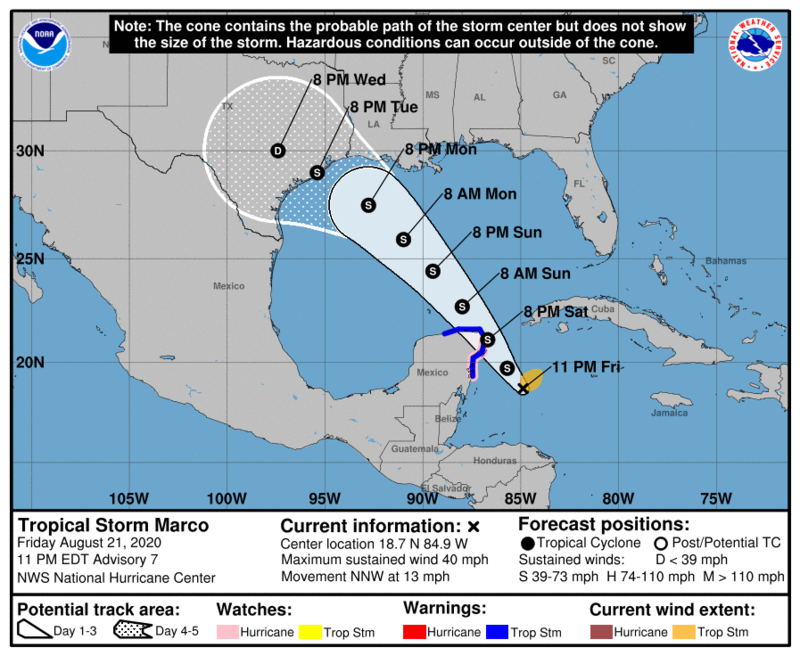
This morning the NHC website no longer has the storm as a hurricane at the point of landfall on the Yucatan. It must be right on the cusp.Not the bedtime reading I was hoping for. 11pm Eastern NHC forecast has it as a minimal Cat 1 hurricane at landfall not that far south of here (Tulum general area by my eyeball). Evidently they placed the center a little further north and it will not pass over Honduras, which would have kept development in check for a little while. 75 mph is still manageable more or less, just fingers crossed it doesn't move much higher
View attachment 606291
That is most likely why it goes from S to H over the warm waters of the Gulf.That’s some warm waters it’ll be entering...let’s hope it veers northeast!
Can y'all make sure the viz is cleared up before Labor day?
cozcharlie
Contributor
Can y'all make sure the viz is cleared up before Labor day?
shouldn’t be a problem unless we get another storm
shouldn’t be a problem unless we get another storm.
I'm putting you in charge!
cozcharlie
Contributor
NHC still confused why it hasn’t strengthened more in a favorable environment. Probably too much dry air.

Similar threads
- Replies
- 0
- Views
- 242
- Replies
- 0
- Views
- 289
- Replies
- 0
- Views
- 478


