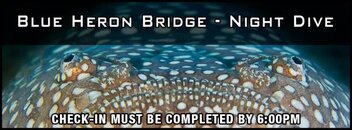
Wahoo! Headed down today to dive Tomorrow with DDD and whomever, and Saturday with Jelly Fish Joy and whomever. Night shore dive at Datura Saturday night as well. YAY!
Here's a forecast I have a free subscription to--next update will be 6PM today. It is a no BS thing.
Friends, What a difference 24 hours will make. This major hurricane will weaken before making landfall, but it hasn't quit intensifying yet. I will be having a Game Day forecast tomorrow.
FORECAST: HURRICANE JOAQUIN is on the Bahamas and intensifying and will get to a Category 4 hurricane briefly as it makes it's turn to the north tomorrow. At that point, HURRICANE JOAQUIN will begin to weaken as it moves north. From the North Carolina north there will be beach erosion, rip tides, elevated surf, and flooding up the east coast.
DISCUSSION: The approaching front will abruptly turn HURRICANE JOAQUIN north. But it is how the hurricane will interact with the front that will determine exactly the path it will take. This may not be well established until Friday afternoon or Saturday morning. Confounding this is the forecast track of the best model historically has JOAQUIN's to the east of the other models There is rational for both of these different scenarios. I will be watching the data closely and send out a forecast as soon as it become a bit clear. We may have to wait for the turn north to know how this storm and front are going to interact. This level of uncertainty is rare, but the consequences are great. Given what is there now, I would not discount a landfall, despite what the European model suggest. JOAQUIN should reveal her hand in the next next 24 hours, when the storm turns north. The good news is that after further intensification over the next day, JOAQUIN will be weakening over the weekend and before any landfall.
NEXT FORECAST: Tonight: 6 pm.
DISCLAIMER: The Florida State University required that I not use any
FSU equipment to send out these forecasts. To comply, I have purchased
my own computer for making and sending these forecasts. I have been
touched by the many offers of encouragement and support that I have
received. I am deeply indebted to the Secretary and the staff of the
Department of Children and Families who value these forecasts for the
citizens of Florida. Also to the firm Hayes Computer Systems, which set
up the distribution software and is providing for the distribution of
these forecasts at no cost. They are very professional and competent. I
acknowledge that these forecasts are mine alone, by my own effort
and initiative. I only try to provide the best possible forecasts for
the community, and the State of Florida and now, surrounding states
at no cost to those who receive it.
NEW BLOG AND DONATIONS:
I have set up a website and blog which may be reached at URL
Weather Solutions In this website
you can find the forecast, as well as a blog of expanded interests of mine dealing with weather and climate and hurricanes, and an opportunity for you to comment as well. There is also an opportunity for you to contribute to defraying the increasing costs of maintaining this service, if and only if you want to. This must always be a not for profit public service and free as long as I have anything to do with it. But I have had offers of help in the past and it is increasingly difficult for me to underwrite all the cost, even with the generous and gracious support form Hayes Computer Systems.
SUBSCRIPTIONS:
Please do NOT send subscription messages to
hurricane-forecasts@lists.hcs.net.
To subscribe or unsubscribe to the hurricane forecast list send an email
to
hurricane-forecast-request@lists.hcs.net with "subscribe" or
"unsubscribe" as the subject. You can manage your subscription at:
hurricane-forecast Info Page
If someone wishes to contact me, they can send an email to
hurricanehunter007@gmail.com.
Peter S. Ray
_______________________________________________
hurricane-forecast mailing list
hurricane-forecast@lists.hcs.net
hurricane-forecast Info Page
