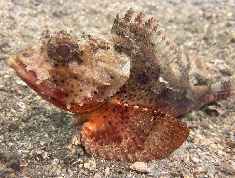
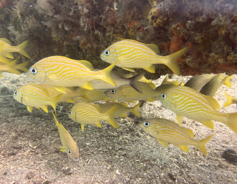
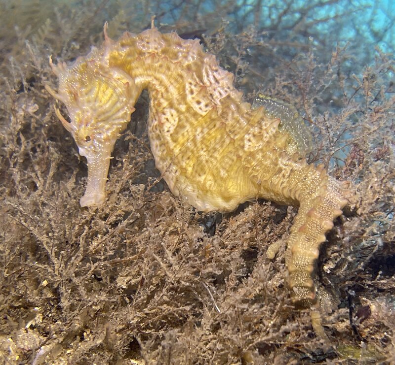
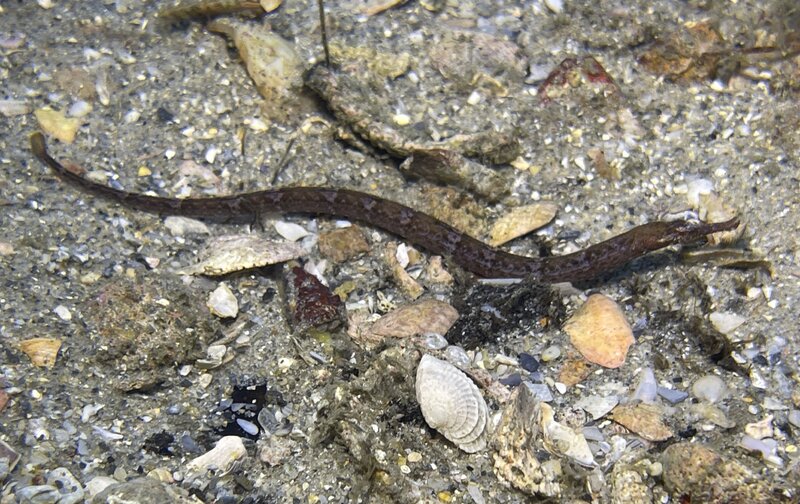
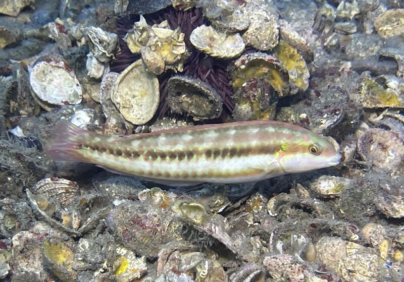
Went to the bridge for diving today. Arrived at 1210 for a 1426 high tide. The park was not crowded. Snorkeled the trail prior to diving. Did a REEF fish survey of 52 species in 45 minutes. Entered the west side on scuba at 1325. Visibility was slightly improved from yesterday at about 25ft, sea temp remained the same at 84f. Upon entering the water I observed the following species in the first minute, Slender Mojarra, Mottled Mojarra, Silver Jenny, Permit, Tomtate, Sailors Choice, Gray Snapper, Silver Porgy, Blue Runner, Yellow Jack, and French Grunt. Did a REEF fish survey of 69 species in 90 minutes. So, 16% of the species in 1.1% of the time. Other notable species observed were Lined Seahorse, Shortfin Pipefish, and Reef Scorpionfish. Respectively, Barbfish, French Grunts, Lined Seahorse, Shortfin Pipefish, and Slippery Dick.
You are using an out of date browser. It may not display this or other websites correctly.
You should upgrade or use an alternative browser.
You should upgrade or use an alternative browser.
Blue Heron Bridge Trolls III
- Thread starter BHB ScubaTroll
- Start date
Please register or login
Welcome to ScubaBoard, the world's largest scuba diving community. Registration is not required to read the forums, but we encourage you to join. Joining has its benefits and enables you to participate in the discussions.
Benefits of registering include
- Ability to post and comment on topics and discussions.
- A Free photo gallery to share your dive photos with the world.
- You can make this box go away
Any idea of the forecast for Sept 16-19? Scheduled a couple dives then. Looks like the new hurricane could make it a no go.I stumbled across a decent map of the place
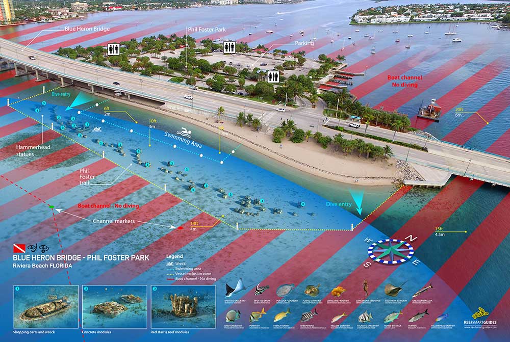
Blue Heron Bridge (Phil Foster Snorkel Trail) - Reef Smart Guides
Reef Smart Guides wall art is available for a limited number of premium dive and snorkel sites. These high-resolution images are available in the following formats: Paper, small (16x24 inches) $25.99 Laminated, small (16x24 inches) $35.99 Paper, large (24x36 inches) $41.99 Laminated, large (...reefsmartguides.com
Forecasts more than a few days out are not so reliable.Any idea of the forecast for Sept 16-19? Scheduled a couple dives then. Looks like the new hurricane could make it a no go.
Currently, Hurricane Lee & TD14 are both forecast to go north before slamming into Florida.
Lee is the closer of the two storms. Most forecasts have it building to Cat 4 or more. This is the closest track prediction I have seen so far -
...but you never really know what will happen in a week.
Keep your eyes open. Have another look in a few days. Don't be surprised if other storms pop up by then as well. It's that time of year. If it's too rough to dive, try to find a hurricane party somewhere.
Click on the individual storm for more details.
Like PB said, it's too far out. The good news is that we typically only have to worry about vis at BHB. It could be 6ft waves at the beach and a non-issue at the bridge.Any idea of the forecast for Sept 16-19? Scheduled a couple dives then. Looks like the new hurricane could make it a no go.
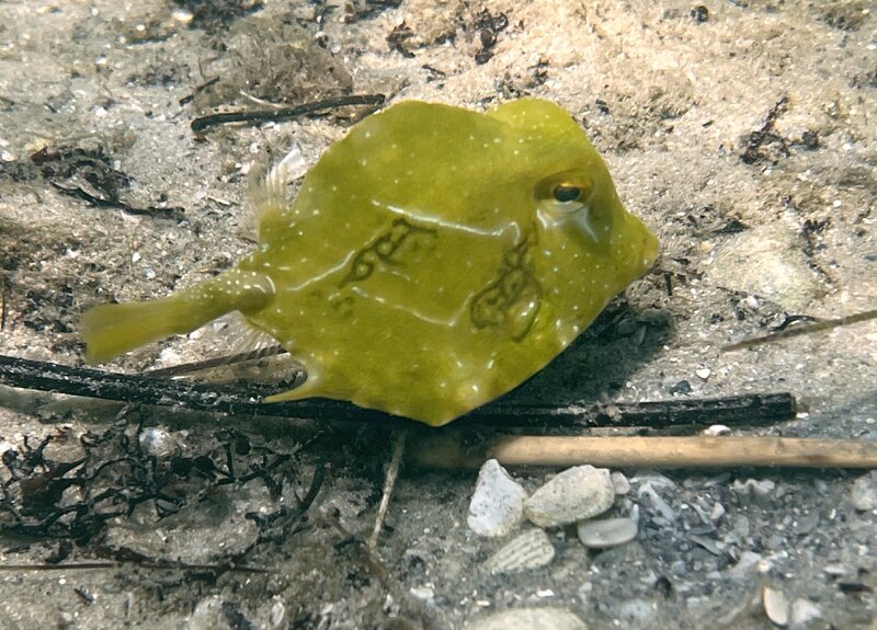
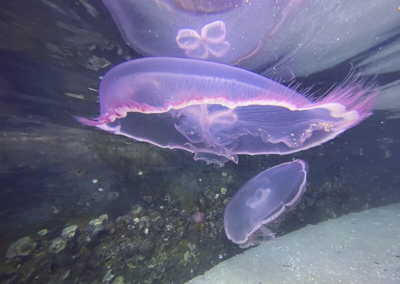
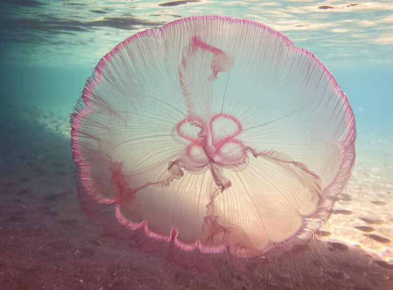
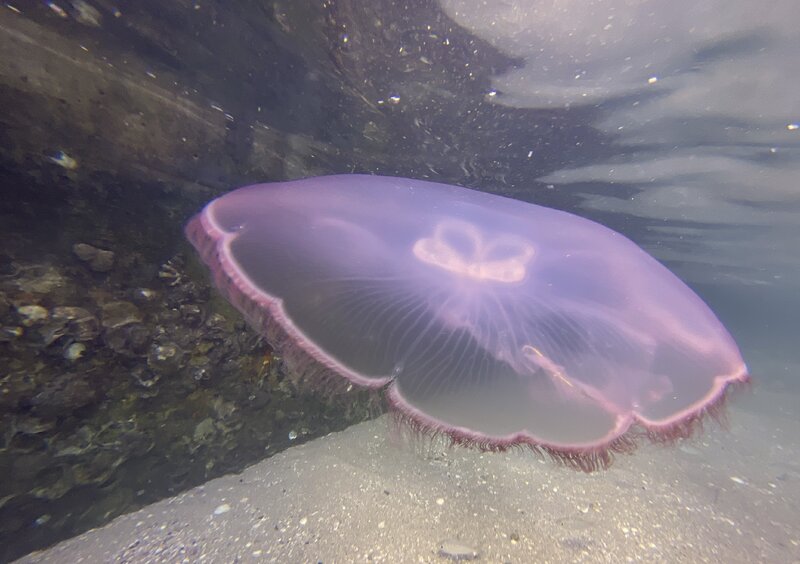
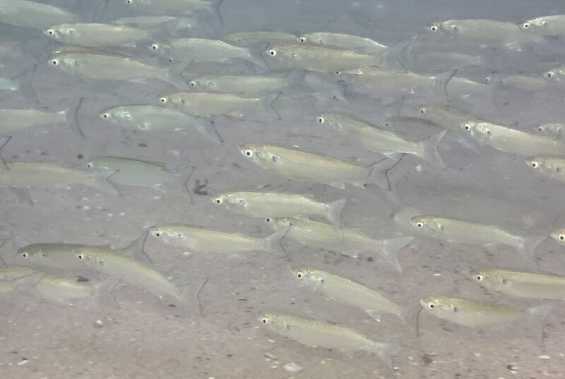
Went to the bridge for snorkeling only today. Arrived at 1250 for a 1530 high tide. The park was not crowded. Entered the water at 1320 on the east side to drift westward along the snorkel trail with the current. Sea temp was 84f, and visibility was improved from yesterday, at about 35ft. Today was Moon Jellyfish day. They were everywhere, and you could see individuals on the beach unwilling to enter the water because of such an abundant presence. When life gives you Moon Jellyfish, you take Moon Jellyfish images, and make Moon Jellyfish Video. Along with the Moon Jellies I observed some White Mullet at the bridge, first time this year. Respectively, Juvenile Trunkfish, Moon Jellyfish, Moon Jellyfish, Moon Jellyfish, White Mullet, Moon Jelly Video, and Moon Jelly Video.
The most prominent effects at the bridge that I would expect from an off shore hurricane would be reduced visibility & perhaps colder water temperatures. There are pockets of 70-something degree water not so far off shore -Any idea of the forecast for Sept 16-19? Scheduled a couple dives then. Looks like the new hurricane could make it a no go.
A big storm can push that up into the shallows & cause a rather sudden change. I've sometimes seen changes in excess of 10 degrees in a single day when large storms are around. I'm probably going to put a 3/2 full suit back in the truck for a while.
https://www.ospo.noaa.gov/data/ocean/ohc/images/ohc_naQG3_ddc.gif
Recent hurricanes have soaked up some of the surface water heat already. The map graphic above isn't showing as much red as it did a couple of weeks ago (thank god).
The first map was heat. This one is temperature. We still have a long way to go before hurricanes stop getting fueled by hot water. https://www.ospo.noaa.gov/data/ocean/ohc/images/sst_naQG3_ddc.gif
82F or 28C is the temperature that starts to kill off the hurricanes.
Green Frog
Contributor
Interesting. So it looks like hurricanes that absorb heat from seawater could actually be a positive thing from a global warming standpoint… Ol’ Ma Nature may be doing what she’s been doing for the last couple of BILLION years, huh? I’ll be interested to see what the temp profiles through the Winter and Spring look like after the effects of hurricane system have had time to… take effect!

Those are some truly fantastic jellyfish shots.
interesting..Interesting. So it looks like hurricanes that absorb heat from seawater could actually be a positive thing from a global warming standpoint… Ol’ Ma Nature may be doing what she’s been doing for the last couple of BILLION years, huh? I’ll be interested to see what the temp profiles through the Winter and Spring look like after the effects of hurricane system have had time to… take effect!

Similar threads
- Replies
- 2
- Views
- 412
- Replies
- 12
- Views
- 1,813
- Replies
- 2
- Views
- 835
- Replies
- 3
- Views
- 1,108


