90L, 91L, 92L (Humberto?)

Please register or login

Welcome to ScubaBoard, the world's largest scuba diving community. Registration is not required to read the forums, but we encourage you to join. Joining has its benefits and enables you to participate in the discussions.

Benefits of registering include

  • Ability to post and comment on topics and discussions.
  • A Free photo gallery to share your dive photos with the world.
  • You can make this box go away

Joining is quick and easy. Log in or Register now!

Looks like Humberto will hold off the DFW metroplex for this weekend. If it would rain Mon- Thursday I would be happy, keep my weekends dry!!! Thanks for the links everyone!
 
Oh ok, looks like has just been upgraded from TD9 to TS Humberto.
Statement as of 1:00 PM CDT on September 12, 2007

...Tropical depression strengthens into a tropical storm...

a Tropical Storm Warning remains in effect from Port O'Connor Texas to Cameron Louisiana. A Tropical Storm Warning means that tropical storm conditions are expected within the warning area within the next 24 hours.

A tropical storm watch remains in effect from east of Cameron to
Intracoastal City Louisiana. A tropical storm watch means that
tropical storm conditions are possible within the watch
area...generally within 36 hours.

For storm information specific to your area...including possible
inland watches and warnings...please monitor products issued
by your local weather office.
[c]
at200709_windprob34.gif

[/c]
 
Looks like Humberto is going to rake the coast a bit...

427999cc.gif

 
Hurricane Humberto update...

Posted by: JeffMasters, 7:56 AM EDT on September 13, 2007
A surprise Hurricane Humberto ripped into Texas near the Louisiana border this morning, bringing winds of 85 mph and torrential rains to the coast. Humberto didn't even exist yesterday morning, and grew from a tropical depression at 11am EDT to a hurricane just 14 hours later. As the hurricane intensified, it grew in size and height, allowing the storm to respond to upper-level winds that changed its course to a north-northeastly path. This allowed Humberto to stay over water parallel to the coast for the crucial hours needed for it to reach hurricane strength. Storms like Humberto give us the sobering reminder that as much as hurricane forecasting has improved in recent years, there is still much we do not understand--particularly in regards to intensity forecasting. If Humberto had had another 12-24 hours over water, it could have been a major hurricane that would have hit without enough time to evacuate those at risk.

Port Arthur, TX, on the border with Louisiana, has taken a heavy hit from Humberto. A portion of an apartment complex's roof was ripped off by the storm's winds, and fell on four vehicles. Widespread power outages were reported, with heavy flooding. A Personal Weather Station in downtown Port Arthur recorded a rainfall rate of over 2 inches per hour before failing at 3:30am EDT; a second station in the city recorded a minimum pressure of 989.7 mb before it, too failed. Nearby Beaumont, TX recorded sustained winds of 54 mph, gusting to 84 mph, at 5am EDT. On the coast where Humberto came ashore, McFadden wildlife Refuge measured sustained winds of 60 mph with a gust to 75 mph at 3:35am EDT. Winds of 67 mph gusting to 76 were recorded at nearby Sabine Pass. A crane at a work site at Sabine Pass recorded a wind gust of 118 mph at a height of 40 feet.

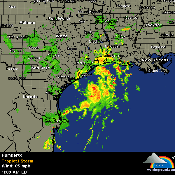
While some moderate wind damage will affect Port Arthur and surrounding areas, and two tornadoes were reported near Galveston, the main threat from Humberto remains its rains. Estimated rain from the Lake Charles radar (Figure 2) show that amounts in excess of ten inches have fallen near Beaumont, with some higher amounts on the Louisiana coast over an unpopulated swampy area. Rains in excess of ten inches may fall along the path of Humberto as it plows through central Louisiana and into Mississippi. The storm may stall out and die over Mississippi, over the weekend, making for a dangerous flooding situation there. Hopefully, Humberto's rains will make it to Alabama, which is suffering its worst drought on record.

Since making landfall, has been downgraded to Tropical Storm Humberto
 
Ingrid (formerly I91) looks to be very short lived. Wind shear is going to chop the top off her:

FIXES FROM A NOAA RECONNAISSANCE PLANE WHICH IS CURRENTLY ON A
RESEARCH MISSION INDICATE THAT THE CENTER OF INGRID IS CLOSER TO
CONVECTION. THE MINIMUM CENTRAL PRESSURE IS 1004 MB. BASED ON THE
AVERAGE OF FLIGHT-LEVEL WINDS AND SFMR DATA FROM THE PLANE...AND
DVORAK T-NUMBERS OF 3.0 FROM TAFB AND SAB...THE INITIAL INTENSITY
HAS BEEN ADJUSTED UPWARD TO 40 KNOTS IN THIS ADVISORY.
HOWEVER...THIS INTENSITY IS NOT EXPECTED TO LAST SINCE INGRID IS
HEADING TOWARD A STRONGER THAN NORMAL SHEARED ENVIRONMENT. THE
STRONG UPPER-LEVEL WESTERLY WINDS FORECAST BY GLOBAL MODELS ARE
ALREADY OBSERVED ON SATELLITE IMAGERY AND ARE IMPINGING ON THE
CYCLONE...OR AS IT HAS BEEN SAID FOR YEARS IN THE SATELLITE
JARGON...A DAGGER THROUGH THE HEART. THEREFORE...A GRADUAL
WEAKENING IS FORECAST. IT IS POSSIBLE THAT INGRID WILL NOT LAST
THROUGH FIVE DAYS. IN FACT...THE CLOUD PATTERN HAS ALREADY BEGUN
TO DETERIORATE SINCE THIS MORNING'S CLASSIFICATIONS.

So, it looks like I90 surprised everyone by turning into a hurricane, I91 will have gotten named and then blown apart, and I92 never really got up any steam...

No tropical storm formation for the next 48h, there's some tropical waves lined up out there which could develop into I93, etc:

..TROPICAL WAVES...

TROPICAL WAVE IS TITLED FROM 16N26W TO 3N28W MOVING W 10-15
KT. A 1010 MB LOW IS ANALYZED ALONG THE WAVE AXIS NEAR
10N...CONFIRMED BY A BROAD AREA OF CYCLONIC TURNING IN AN
EARLIER QSCAT PASS. OVERALL...THIS WAVE HAS CHANGED LITTLE OVER
THE PAST 24 HOURS WITH CONVECTION LIMITED AND DISORGANIZED. A
CURVED BAND OF SHOWERS WITH ISOLATED TSTMS IS ON THE NORTHERN
END OF WAVE AXIS. THE REMAINDER OF CONVECTION IS WITHIN THE ITCZ
AXIS. THE UW-CIMSS TPW ANIMATION SHOWS A WELL DEFINED WIDE
MOISTURE PLUME ASSOCIATED WITH THIS WAVE...MAKING IT EASY TO
TRACK.

TROPICAL WAVE IS ALONG 41W S OF 17N MOVING W 5-10 KT. MOST OF
CONVECTION ASSOCIATED WITH THE WAVE IS WITHIN THE ITCZ. THIS
WAVE IS STILL SHOWING AN INVERTED V-PATTERN ON VIS SAT IMAGERY.
SCATTERED MODERATE CONVECTION IS FROM 4N-8N BETWEEN 38W-42W.

TROPICAL WAVE IS ALONG 63W S OF 19N MOVING W 10-15 KT. THE SSMI
DERIVE TPW INDICATES THE PRESENCE OF THIS WAVE AS WELL AS SFC
DATA. THE WAVE IS GENERATING SOME SHOWER ACTIVITY OVER THE
SOUTHERN WINDWARD ISLANDS AND NE VENEZUELA.

TROPICAL WAVE IS OVER THE YUCATAN PENINSULA AND GUATEMALA INTO
THE EPAC WHERE THERE IS A BROAD AREA OF CYCLONIC TURNING AND
CLUSTERS OF MODERATE TO ISOLATED STRONG CONVECTION.
 
https://www.shearwater.com/products/perdix-ai/

Back
Top Bottom