Ok, so the Saturday model is just starting to come in from CDIP (
CDIP recent forecast fm_mon_xxx) and it looks like off-shore there will be something around a 6' swell from the NW. Looking at the information on (
Monterey Sea Conditions at a Glance), it says that a 6' swell is "passable" diving. So a few questions...
1) Does the CDIP model only have the swell height or does it include wind waves, for a combined seas calculation?
2) In Chuck's guide (
http://www.garlic.com/~triblet/swell/UPSSwell.pdf) is he referring to the offshore swell heights, or the colors at shore?
3) If we have a NW swell at 6', what can I expect Pt. Lobos to be like for diving Middle Reef? Would it be too rough for 2 beginners?
If I'm going to cancel my trip, the latest I can cancel my hotel is on Wednesday.
I also came across this handy map (
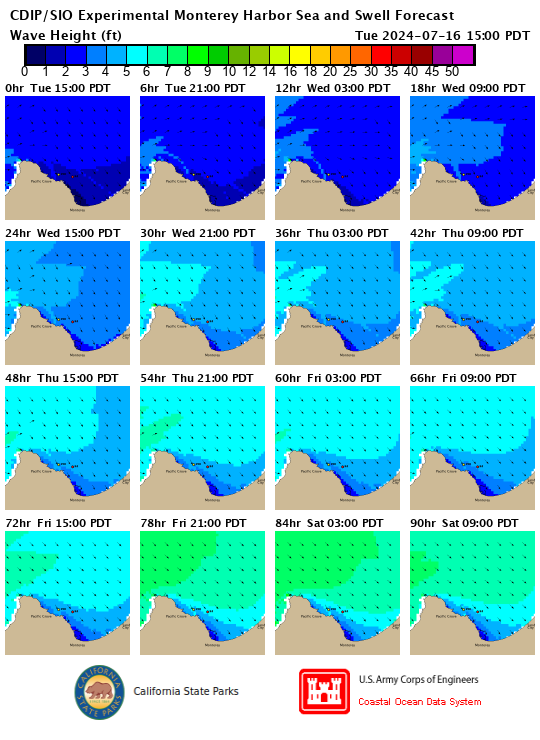
Models Home). If you go to the top and select the "Harbors" and "Forecast" you get a nice up close view of Monterey like this....
Too bad it doesn't show Carmel, but it's something. A big thank you to Chuck for putting that website together that complies all this information, I'm sorry to hear that he has pasted away, but at least it's still being updated. It has been a tremendous help for me as well as all of the advice on here, thanks again!


