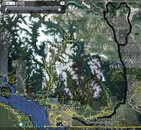
On our way in we went through Lillooet. On our way back we went by Cache Creek. I took my GPS with me and was monitoring altitude changes on our way in. I did not like the big altitude changes so close to the Lake while on our way in. The return through Cache Creek was much smoother in terms of altitude changes. The Lillooet way is shorter and slightly quicker (~5-10 mins), but Cache Creek was safer in terms of DCS avoidance.
Bighiller was using 32%. I was using 36%. Marty was on air, but he only did one dive. All the rest of us did two dives. Cristina was also on air, but she didn't have the altitude changes we had on her way back home (she lives up in the mountains).
Marty (AKA asksjasd) and I met Mike (AKA bighiller) at the Chevron Station in the 232 St and Hwy 1 interchange. We left the gas station at 6:30am. We arrive at the Lake by 10:10am after doing only one 10 min stop for refueling at the last gas station before arriving at the Lake.
Once we got to the lake, I guess I was looking for larger/better marked pullouts, parking spaces and entry points than what was actually available. That's when Cristina (AKA seahorsey) came in and saved the day. She saw us drive by and chased us all the way to the southern end of the Lake. Then she took us to the right entry spot for the central recreation zone.
Our first dive was 32 mins long. Visibility was great, about 70', but Cristina says this is the worst she's ever seen in the Lake. Vis was better near the top. My max depth was 83'. There's lots of microbialites everywere. I was also surprised to see plants in the 80 feet range. Tells you something about the predominant clarity of the water that allows enough light through for photosynthesis to take place 80' below.
We did a surface interval of 95 mins. Then we went back in for a 53 min dive. My max depth was 85'. There was a lot of particulate in the water that was contributing to reduce the vis to 70'/80'. All of a sudden Mike points out to the particulate floating just around his camera lights. They are actually tiny little shrimplike creatures. Lots of them.
So we pack up and hit the road again by 3pm. We stop in Cache Creek for a 30 min meal break, which also allows us 30 extra mins of offgassing before hitting the adverse altitude changes. There were no gas stops on the way back. We arrived at the Chevron station in 232St and Hwy 1 by 7:05 pm.
Overall, it's not that bad for a day trip. It's not something I would do every weekend, but it is totally bearable. It was much better than a day trip to the Powell River mermaid I did a couple of years ago, where we had to deal with delayed, overfilled ferries and ended up getting home past midnight.
I want to publicly extend my gratitude to Cristina for being our guide in and out of the water. Please do let us know when you come down here for some ocean dives. We would like to return the favor.
This link will allow you to download a Google Earth file of my gps log for the trip. You will need to have Google Earth installed in order to view it.
Mike took some footage. I assume he's going to post it somewhere here when he's done editing.


") . You can return the favor if I come to Vancouver, just send me to some dark cramped parking garage...
. You can return the favor if I come to Vancouver, just send me to some dark cramped parking garage...