Went for a dive today at Datura in LBTS to use up a leftover half tank.
There was enough of a shore break that some sort of surfing lessons were happening, not so rough as to make the entry or exit overly challenging though.
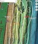
Water was cloudy near shore. temp 84, visibility probably 25 feet, rising as i went east. lots of people out snorkeling and diving, and I thought more fish than usual.
Highlight for me was that a spotted eagle ray came and did a couple of circles around me as i was coming in, right by the closest buoy to the costa del sol hotel.
(vertical video with not the best clarity, apologies)