Calling Monterey shore divers

Please register or login

Welcome to ScubaBoard, the world's largest scuba diving community. Registration is not required to read the forums, but we encourage you to join. Joining has its benefits and enables you to participate in the discussions.

Benefits of registering include

  • Ability to post and comment on topics and discussions.
  • A Free photo gallery to share your dive photos with the world.
  • You can make this box go away

Joining is quick and easy. Log in or Register now!

We put a GPS in a case to mark objects. Works pretty darn good. Send it up to the surface and give it a minute or two, then wind it back down.

Will you elaborate on the type of case you used, what you used to send it to the surface and if the GPS had to be elevated above the surface.

thx
 
Will you elaborate on the type of case you used, what you used to send it to the surface and if the GPS had to be elevated above the surface.

thx

At the time it was an old 50 halogen light canister with the lead acid batteries removed, and GPS unit installed. Quite clunky and hard to stow on the right side of the BP/W waist harness. We used a 150 ft spool for launch and recovery. Now there is a custom one, but it has not been tested yet. The GPS only has to have an unrestricted eye to the sky for a short period of time.
 
I wonder how much it would cost to buy a remote antenna and some coax along with two enclosures. Pop the antenna to the surface and keep the unit in your hand... hitting the button to make a waypoint though would be interesting.
 
I wonder how much it would cost to buy a remote antenna and some coax along with two enclosures. Pop the antenna to the surface and keep the unit in your hand... hitting the button to make a waypoint though would be interesting.

Sounds like a combination of a can light (with a longer cord) and an uw camera housing :)

Seems a bit over the top considering the size of portable GPS units nowadays. There are thumbdrive sized GPS receivers used for geotagging photos or providing location service to mobile phones. All you need to do is turn them on, and they continually log their position every minute or so until the battery runs out (several hours). No buttons needed. I imagine you could use a smaller waterproof box for those, just jot down the time on your slate when you pop it, and when you get home, load up the log and match the timestamps to your slate.
 
I imagine you could use a smaller waterproof box for those, just jot down the time on your slate when you pop it, and when you get home, load up the log and match the timestamps to your slate.

It is nice to have the unit not on a string when passing through kelp beds and traveling at scooter speeds. So launching from depth to the surface I would consider important.

You can also sync your camera with your gps time clock, instead of a slate. The slate will work well though. Just depends what you are tying to accomplish.
 
Hello Kenn,

Great maps, thanks for your work on this.

Lover's #1 is the stairs and beach at the base of the point on the southeast side.

#2 is just a bit further out on the point also on the southeast side

#3 is on the opposite (northwest) side of the point

If I get time I'll try to mark-up your map with their exact locations an send it your way.

Ken (with 1 'n')

BTW, are you the same Kenn who has a youtube vid of a Macabee dive playing with a harbor seal? I came across that last week and loved it. Hope to have a similar encounter some day
 
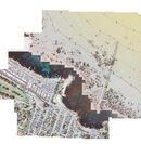
Attatched map with 1,2,3 penciled in red at the water entry points.

They are in order of ease of entry with one being very protected and gradually sloping sand. Others things I have found firsthand: #2 is rocky and shallow just off the beach and can be difficult and not advisable at low tide. #3 always seems to have larger breaking waves than any of the other Monterey shore sites. It also is made more difficult on a high tide as the tiny beach can disappear and make for a rocky entry.

BTE- Each entry point has a convienient staiway taking guesswork out of it completely

I have found descriptions online as well you could try looking up.

Hope this is a help, I have gained so much helpful info from SB , I'm glad to help someone else in return.

-Ken
 

Attachments

  • lover's point.jpg
    lover's point.jpg
    116.9 KB · Views: 46
A few weeks back one of my regular buddies and I entered at Lovers 3, and dove around the point to exit at Lovers 1. It was actually really cool. Saw a guitar fish, and an egg sac from a skate or shark or something.
 
Ken,

Thanks very much for the graphic, I'll include the three entries on the map.

A few weeks back one of my regular buddies and I entered at Lovers 3, and dove around the point to exit at Lovers 1. It was actually really cool. Saw a guitar fish, and an egg sac from a skate or shark or something.

My only dive at Lovers was exactly what you described above, sans guitarfish/thornback, egg sacks or anything else of a sharky nature. I do remember it being a very shallow dive - 20-30fsw or so.
 
At the time it was an old 50 halogen light canister with the lead acid batteries removed, and GPS unit installed. Quite clunky and hard to stow on the right side of the BP/W waist harness. We used a 150 ft spool for launch and recovery. Now there is a custom one, but it has not been tested yet. The GPS only has to have an unrestricted eye to the sky for a short period of time.

I was thinking one of those soft, clear, bag-type cel phone/walkie talkie type cases would work well for a gps unit, and the button would be pushable. Has that been tried?
 
https://www.shearwater.com/products/swift/

Back
Top Bottom