


- Messages
- 10,954
- Reaction score
- 4,130
- # of dives
- None - Not Certified
We are well on the way, but as always, who knows what tomorrow may bring?
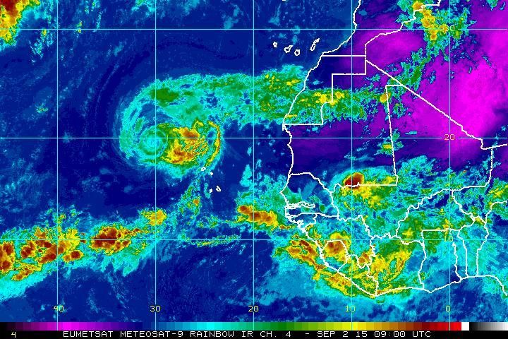
For immediate images and relevant links to every other useful site: Jay's Hurricane Images - Real-Time Imagery of Tropical Storms
Watch the Equator of Africa. These storms usually start there- being spit out light a machine gun.
They then track Eastward across the Atlantic, heading for the NE South American coast.
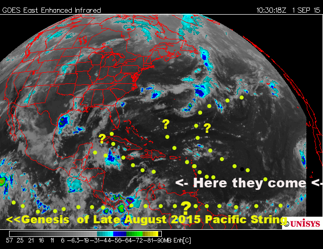 (09/01/15 image)
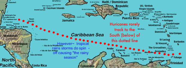
They either continue on an Equatorial path (as they have to enter and spawn the current Pacific record of three-at-once), or get "lifted" in a clockwise curve... how much of a curve? Before the Windward Islands? In the Caribbean...hitting Belize, Coz, TX, LA or FL?
Let the betting begin!
Here's my general take and comment:
Some historical data in no particular chronological order....
Note the actual dates within the seasonal map itself, certain periods of August-December will generally create more clockwise lift.
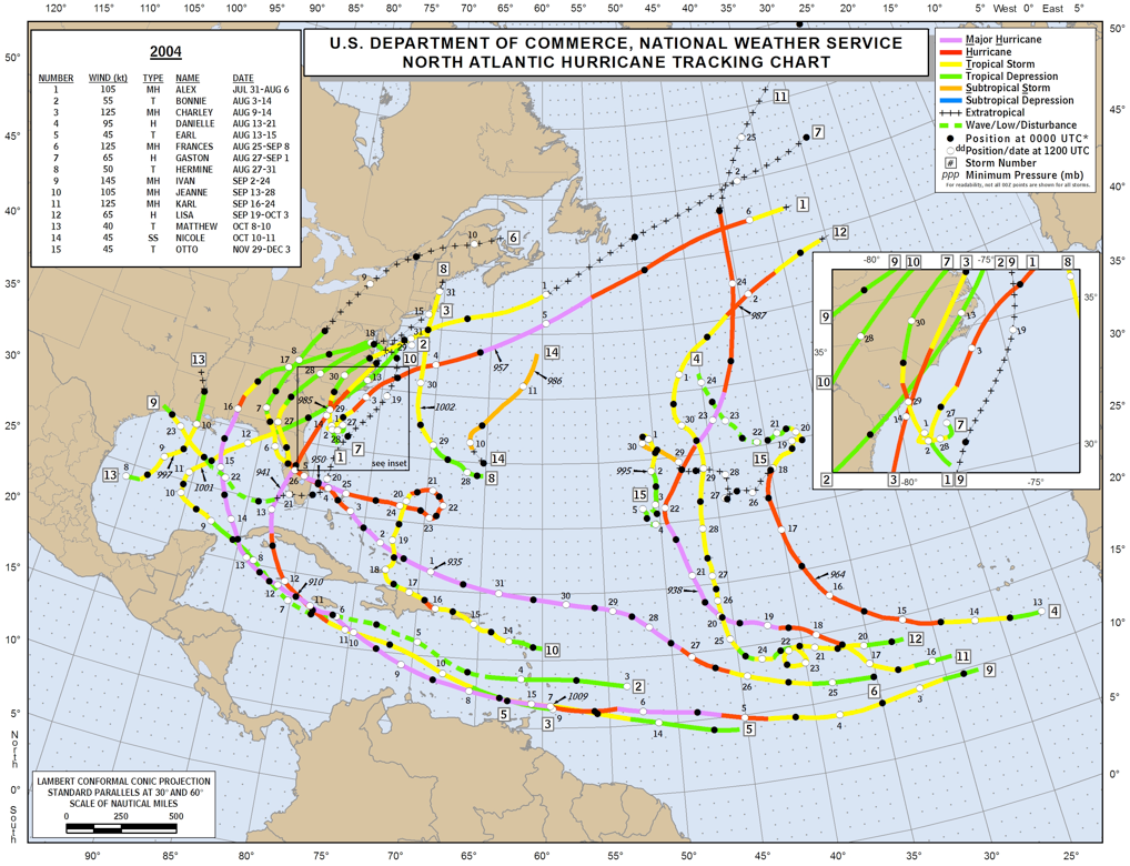
2004 a busy year, very discernible clockwise lift
2006, lighter, but clockwise lift as above in 2004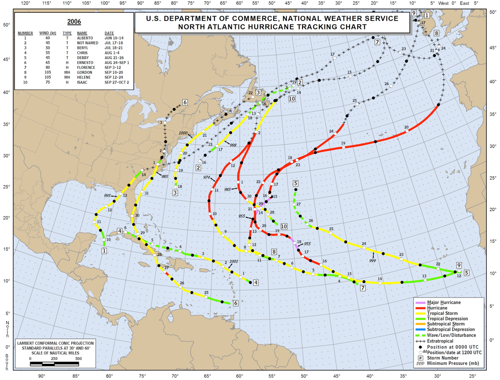
2005 was a busy year, NOT a whole lot of "lift", patterns ill defined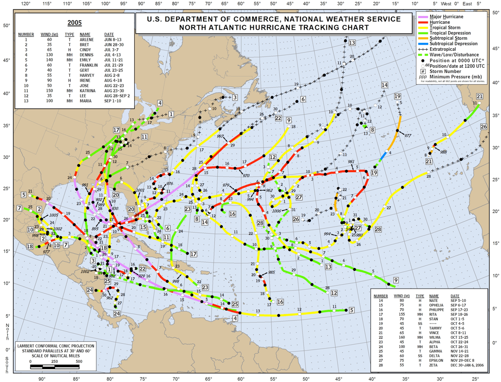
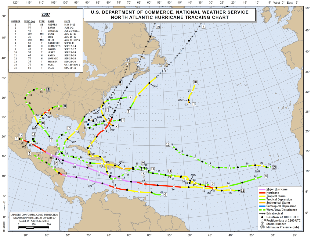
2007, no appreciable lift
2008 looks atypical at first glance, then it becomes "the norm"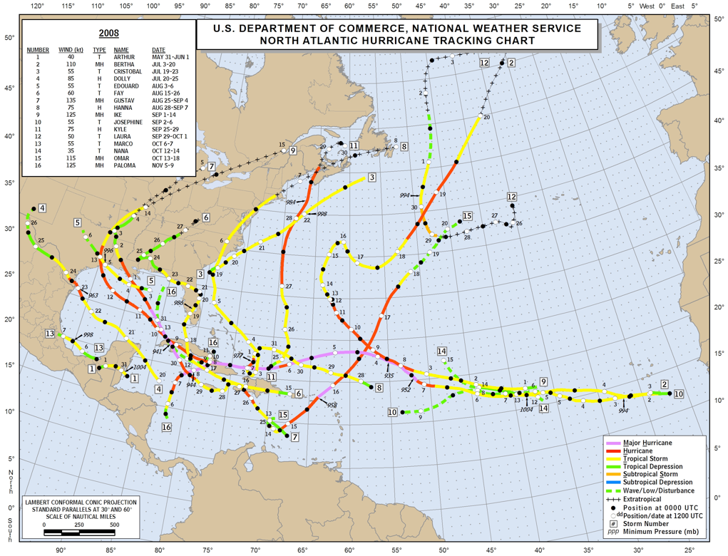
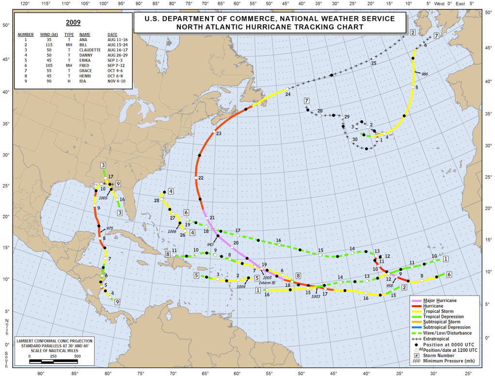
2009 pretty listless
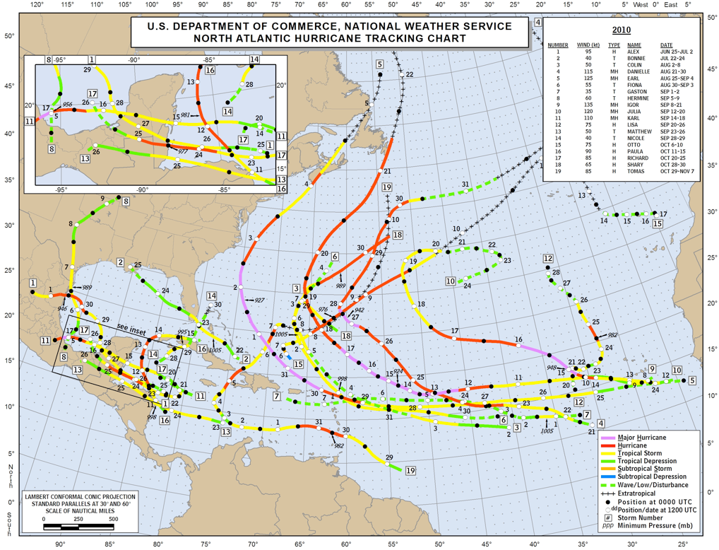
2010 perked up
2003 showed some very early lift and unusual (mid-Atlantic) rotation counterclockwise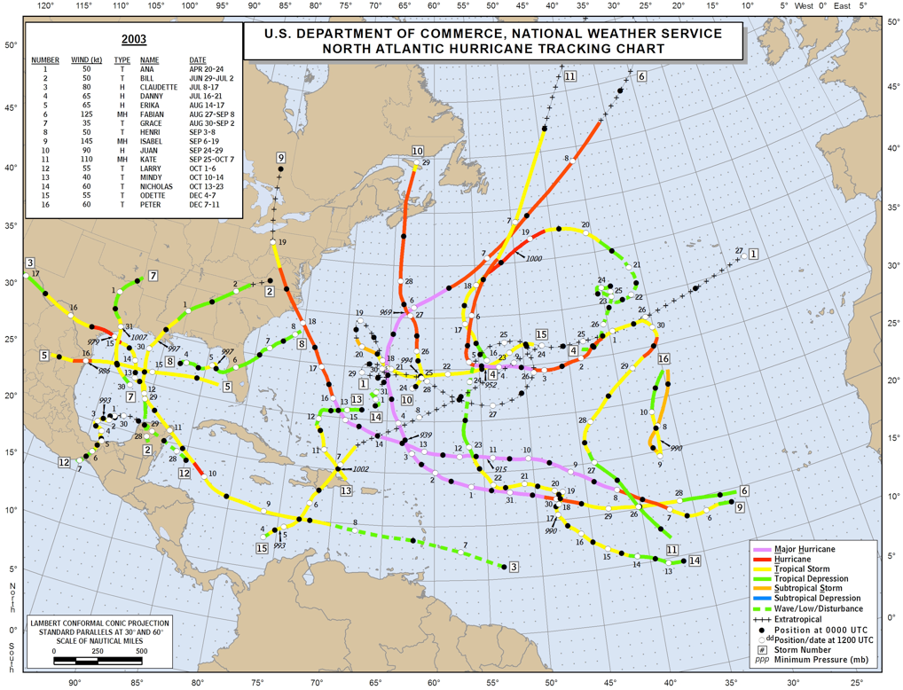
1998 of course, the contradictory Hurricane Mitch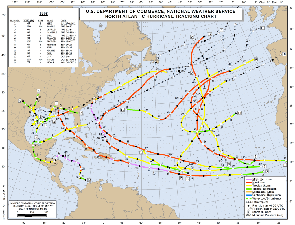
---------- Post added September 2nd, 2015 at 04:51 AM ----------
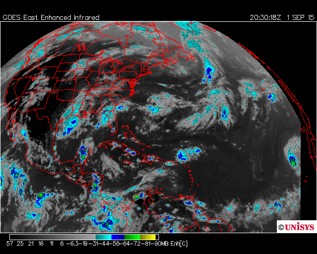

For immediate images and relevant links to every other useful site: Jay's Hurricane Images - Real-Time Imagery of Tropical Storms
Watch the Equator of Africa. These storms usually start there- being spit out light a machine gun.
They then track Eastward across the Atlantic, heading for the NE South American coast.
 (09/01/15 image)
They either continue on an Equatorial path (as they have to enter and spawn the current Pacific record of three-at-once), or get "lifted" in a clockwise curve... how much of a curve? Before the Windward Islands? In the Caribbean...hitting Belize, Coz, TX, LA or FL?
Let the betting begin!
Here's my general take and comment:

Some historical data in no particular chronological order....
Note the actual dates within the seasonal map itself, certain periods of August-December will generally create more clockwise lift.
2004 a busy year, very discernible clockwise lift

2006, lighter, but clockwise lift as above in 2004

2005 was a busy year, NOT a whole lot of "lift", patterns ill defined

2007, no appreciable lift

2008 looks atypical at first glance, then it becomes "the norm"

2009 pretty listless

2010 perked up

2003 showed some very early lift and unusual (mid-Atlantic) rotation counterclockwise

1998 of course, the contradictory Hurricane Mitch

---------- Post added September 2nd, 2015 at 04:51 AM ----------


Last edited:


