I'm trying to figure out how the scan was done. Magellan doesn't list laser scanning in their services. I am asking around to find out.
EDIT: "
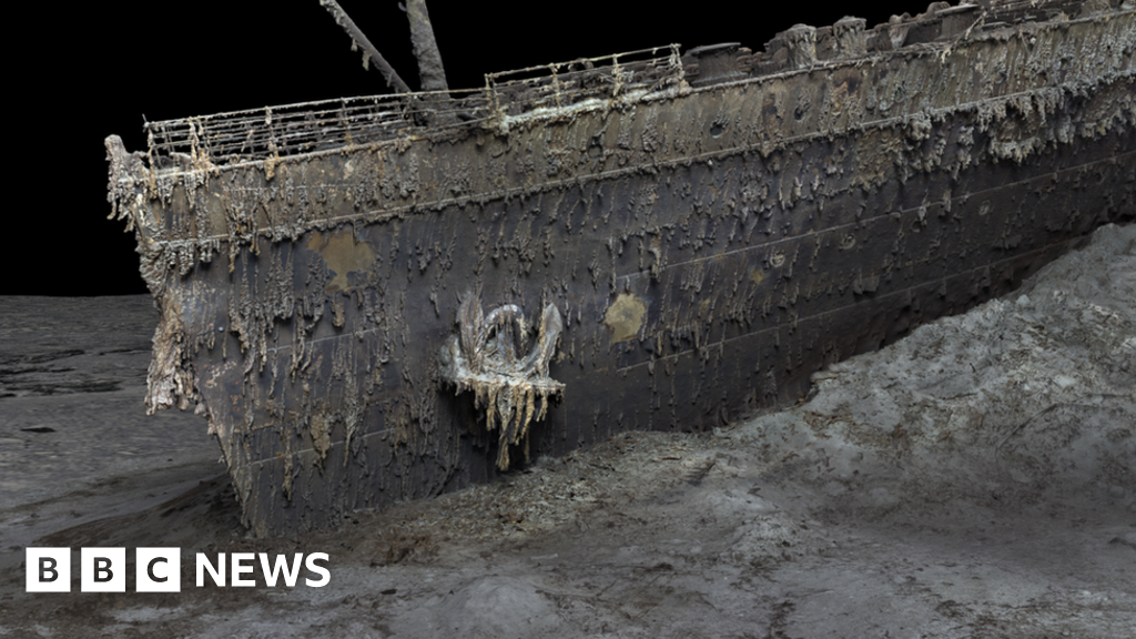
No lasers were used. 700,000 photos lighted by the ROV. People need to stop calling photos as scanning, it make it confusing to readers. They used Voyis's new camera system." - a laser scanning/photogammetry expert I know. The Voyis camera system used was the Observer Camera System.
EDIT2:
"
It's taking photos/videos and creating an orthomosaic "map".
Then uses specialty software to calculate the depth of field from the commonalities of each photo to create a 3D point cloud of projected points.
Those point clouds are similar to the points you get from LiDAR.
The photogrammetry models on my website are created the same way.
This system by Voyis is unique because it is specifically calibrated to work underwater."
View attachment 783880


 www.bbc.com
