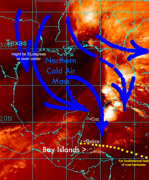
These are called "NORTHERS".
A simple thing to watch: When Texas gets a
COLD SPELL... I mean the kind that delivers SNOW or sub-freezing temps... this causes a NORTHER. They appear from DEC>FEB
Here's one from today's images....
It can heavily affect Cozumel, Belize and the Northern side of the Bay Islands.
Other times during this,
the "rainy season", the drizzles are caused by spin-offs from tropical storms (wannabe hurricanes) that track NW across the Caribbean Basin on their way to Texas. The great majority of Huricanes and Tropical Storms track to the North of the Bay Islands (Note the
YELLOW DOTS •••• and make landfall as close as Belize, but most track further North and just dump buckets of rain to the South.
During the Hurricane/tropical Storm Season AUG>NOV.... A HURRICANE path, most likely Southern limit:
As "statistically safe" as you are to the South of the dotted line, you'll still get wet when one passes by to your North.


")

")

 ...this time tomorrow you will be in warm Roatan