Underwater navigation with a GPS

Please register or login

Welcome to ScubaBoard, the world's largest scuba diving community. Registration is not required to read the forums, but we encourage you to join. Joining has its benefits and enables you to participate in the discussions.

Benefits of registering include

  • Ability to post and comment on topics and discussions.
  • A Free photo gallery to share your dive photos with the world.
  • You can make this box go away

Joining is quick and easy. Log in or Register now!

fisherdvm

Contributor
Messages
3,577
Reaction score
52
# of dives
200 - 499
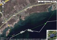
This author made a waterproof housing for his gps with switches on the outside. He floats it up to the surface for a gps reading, and retrieve it underwater to navigate, or assist in his navigation. Interesting read.


Here is a link for the following free book on this topic:

Underwater GPS - Captain's Blog SCUBA Blog - Dive Spots

The link below will allow you to download my book / manual-
"Underwater GPS: a practical approach"
The book is free and is not a promotion for the sale of
any product. I'm distributing this pdf document, in hopes of encouraging the use of Diver GPS by avid divers, researchers, law enforcement dive teams, and public safety divers. I would certainly like to hear feedback or questions from users.
http://wl.filegenie.com/~8675309/UW_GPS_Book.pdf
 
Interesting. I guess if they can't make an inertial navigation system small enough. Have you tried this method?
 
I use this method quite a bit. It works really well.

You should put the GPS in large enough box to give it a lot of flotation. The one I use is 3" x 4" x 6". This lets it float high in the waves so that less water gets over it. Water really obscures the signal.

If you're diving in current, I find that you need to be drifting with the current when you take the reading, otherwise the force on the string will push the box underwater and it won't get a reading.
 
I think it makes a lot of sense, it'll virtually eliminate any need to pop up to look for the boat, you can mark spots, and if you are shore-diving new sites you can easily see what areas you've covered on the map. Fun!

Sorry cave divers :P
 
Learning to use a compass is a lot cheaper and less time-consuming.
 
Learning to use a compass is a lot cheaper and less time-consuming.


Trying to do that with strong current, no land mark or poor visibility, and I'll agree with your point.
 
Interesting link, fisherdvm, thanks for posting it. I like the simplicity of the concept, and you're right that it should help with nav in low viz or current. It doesn't seem to me that it would preclude the use of a compass, but provide more referents from which to take range and bearing measurements - always a good thing for accuracy, since DR has its limits.

Interesting that Thome is quite specific about using thin line, to help control line sag and reduce the effect of current, which seems like it would be the primary drawback to his method. It would be useful to make a careful current calculation at various points during the dive (and a few on the surface in the dive area as well) to create a sense of the difference between the readings one took at the surface and one's actual position on the bottom. Current varies up and down in the water column, but is usually fairly constant over short lateral distances, though, so this should be manageable, and I would think it would be pretty easy to construct highly accurate maps of dive sites if good current information were in hand. The use of the fender float he describes should also help prevent the current from dragging the GPS under during deployment, and allow the line to the surface to be straighter, minimizing current-induced error (the extra flotation is in the float, not the GPS box, and so doesn't have to be dragged underwater for a reading).

One thing I wonder about that Thome doesn't seem to address is the matter of controlling buoyancy while deploying and retrieving the GPS unit. The larger the box, the more positive buoyancy it's likely to have for a given material, and the more effect on one's buoyancy control. Deep Bound, do you find this to be a problem? (I also wonder if this problem couldn't be mitigated, and the use of the GPS improved, by using one of those waterproof heavy polyethylene handheld radio sleeves - no need for installed buttons, and much cheaper!)

The other thing I wonder about is that Thome doesn't seem to make any reference to a reel for the thin line he's talking about - I would think that 50' of thin line not on a reel would present a significant entanglement hazard, particularly if one used vectran or spectra, which can be very thin, are very strong (much stronger than steel at the same diameters), and can be a real bear to cut. I would think a reel would be an essential part of this rig.

Despite these questions, this seems a very cool way to add detailed data to a dive site map - I have a couple of older GPS units I may try this with - have to see if they preserve the last reading when signal is lost first, though.

Thanks again for the interesting post!:clapping:
 
I have a couple of older GPS units I may try this with - have to see if they preserve the last reading when signal is lost first, though.
I have never seen a handheld GPS receiver that did not (at least all the way back to the venerable old Magellan GPS 310 [from back in Selective Availability days], the original Garmin eTrex, and all that came later).
 
I have never seen a handheld GPS receiver that did not (at least all the way back to the venerable old Magellan GPS 310 [from back in Selective Availability days], the original Garmin eTrex, and all that came later).

I have a Garmin eMap that does *not* preserve the location when it loses signal, so I had to buy a megallan unit for underwater use.
 
One thing I wonder about that Thome doesn't seem to address is the matter of controlling buoyancy while deploying and retrieving the GPS unit. The larger the box, the more positive buoyancy it's likely to have for a given material, and the more effect on one's buoyancy control. Deep Bound, do you find this to be a problem? (I also wonder if this problem couldn't be mitigated, and the use of the GPS improved, by using one of those waterproof heavy polyethylene handheld radio sleeves - no need for installed buttons, and much cheaper!)

I actually add a bit of air to my BC after I release the GPS to the surface, then remove some air before I pull it back down. The reason i don't keep the float on the surface is because I only use the GPS for long dives, which usually brings me into areas with boats, and I don't want to drag a float that would annoy the boaters, and possibly get caught in a boat prop. Like the dive in the attached picture for example...
 

Attachments

  • ech_shore.JPG
    ech_shore.JPG
    64.9 KB · Views: 126

Back
Top Bottom