Tropical Storm Ida aims for Nicaragua and Honduras; I-96 may play in later

Please register or login

Welcome to ScubaBoard, the world's largest scuba diving community. Registration is not required to read the forums, but we encourage you to join. Joining has its benefits and enables you to participate in the discussions.

Benefits of registering include

  • Ability to post and comment on topics and discussions.
  • A Free photo gallery to share your dive photos with the world.
  • You can make this box go away

Joining is quick and easy. Log in or Register now!

DandyDon

Umbraphile
ScubaBoard Supporter
Messages
54,119
Reaction score
8,269
Location
One kilometer high on the Texas Central Plains
# of dives
500 - 999
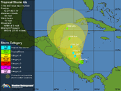
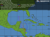
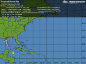
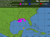
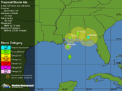
Click maps to enlarge...

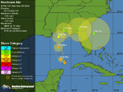
Tropical Storm Ida.gif Tropical Storm Ida - 2.gif
From Dr Masters...
Ida is currently under low wind shear, 5 - 10 knots, and shear is expected to remain in the low to moderate range in the Western Caribbean for the remainder of the week. Sea Surface Temperatures (SSTs) are 29°C and the Tropical Cyclone Heat Potential is about 40 kJ/cm^2, which is enough energy for a hurricane to form, if the center remains over water long enough. The Western Caribbean is plenty moist, and dry air is not an issue for Ida. Ida is currently too small to be affected by tropical disturbance (Invest 96E) 500 miles to its west, over the Eastern Pacific.

The forecast for Ida
The 1 - 3 day forecast for Ida has come into better focus now that the storm has formed, and models have come into better agreement. The current west to northwesterly motion of Ida should carry it inland over northeastern Nicaragua early Thursday morning. Ida is too small to tap the Pacific as a source of moisture, and it is just the northeastern portions of Nicaragua and Honduras that need to be concerned with heavy rains and mudslides. With Ida expected to spend a full two days over land, rainfall amounts of 10 - 15 inches over northeastern Nicaragua and Honduras will likely make Ida the deadliest storm of the 2009 Atlantic hurricane season. There is a medium chance (30 - 50%) that Ida will dissipate while over land. If Ida survives the crossing and emerges into the Western Caribbean on Saturday, low to moderate wind shear and warm waters await it, and strengthening is likely. An extratropical storm is forecast by GFS and ECMWF models to form in the Gulf of Mexico's Bay of Campeche on Saturday, and the counter-clockwise flow of air around this storm may propel Ida northwards into the Gulf of Mexico by Monday. However, both of these models show a high pressure ridge building in and forcing Ida southwards, back into the Caribbean, by the middle of next week. The long term fate of Ida, should it survive the crossing of Nicaragua and Honduras, remains murky.

Jeff Masters
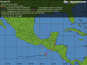
I-96 is just across in the Pacific with possible affects to be determined...

Invest 96.gif
 
Upgraded to Cat-1 Hurricane, closing on Nicaragua.
 
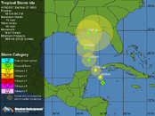
After leaving land headed north for the Cozumel vicinity, Ida has been strengthening and is expected to make Cat-1 by it's close call with Cozumel and Cuba, then continue north to the US as a Tropical Storm...

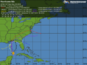
Ida.gif Ida 2.gif
From Dr. Masters: Tropical Weather : Weather Underground
Posted by: JeffMasters, 3:19 PM GMT on November 07, 2009
Tropical Storm Ida is slowly strengthening, as it heads north-northwest towards an encounter with Mexico's Yucatan Peninsula. Infrared satellite loops show that Ida's heavy thunderstorms are expanding in area, and the cloud tops are cooling, indicating that the updrafts in the storm are growing stronger and pushing higher into the atmosphere. Wind shear is a moderate 15 - 20 knots, and is forecast to remain moderate through Sunday night. SSTs are a warm 29°C, and the total ocean heat content is over 100 kJ/cm^2, which is very favorable for intensification. The rains have ended over Nicaragua and Honduras, and Ida dumped up to eleven inches of rain along the coast in Nicaragua, causing flooding that damaged thousands of homes, but caused no deaths or injuries as of yet.

The forecast for Ida
The moderate wind shear of 15 - 20 knots should allow for continued slow but steady intensification of Ida through Sunday afternoon, as long as the center remains over water. I give Ida a medium (30 - 50% chance) of reaching Category 1 hurricane strength before arriving at the Yucatan, since the total heat content of the ocean in the Western Caribbean is so high. We'll have a better idea of Ida's current strength early this afternoon, when the Hurricane Hunters have had time to investigate the storm.

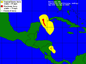
The current wind speed probabilities for Cozumel give the Mexican resort island a 46% chance of receiving tropical storm-force winds of 39 mph of higher, Sunday or Monday. The odds of receiving hurricane force winds are given as 3%. Given the current trend in organization of Ida, these numbers should probably be bumped up to about 60% and 5%, respectively.

Once Ida crosses into the Gulf of Mexico on Sunday night, the storm will encounter much cooler SSTs and a strong trough of low pressure that will dump cold air into the storm and bring 40 knots of wind shear. This will cause Ida to lose its tropical characteristics and become a powerful extratropical storm with 45 - 55 mph winds. It is highly unlikely that Ida will hit the U.S. as a tropical storm, but it could still bring tropical storm-force winds of 45 mph to the coast next week as an extratropical storm.

I'll have an update later today, or on Sunday morning.

Jeff Masters
 
Having been mostly a near miss for Mexico and Cuba, now Cat-2 and headed north. Would be wild for it to cross land and re-enter the Atlantic still active, but we have seen that happen before...!
ida.gif ida 2.gif ida 3.gif ida 4.gif
 
ida.gif
Ida surprisingly weakened to Tropical Storm during the night. Much lessor winds expected on land. Flooding is always the big killer but maybe won't be as bad.
 

Back
Top Bottom