Mapping a dive site

Please register or login

Welcome to ScubaBoard, the world's largest scuba diving community. Registration is not required to read the forums, but we encourage you to join. Joining has its benefits and enables you to participate in the discussions.

Benefits of registering include

  • Ability to post and comment on topics and discussions.
  • A Free photo gallery to share your dive photos with the world.
  • You can make this box go away

Joining is quick and easy. Log in or Register now!

Mike151

Registered
Messages
25
Reaction score
0
Location
Sherman, TX
# of dives
0 - 24
I am looking for software for mapping dive sites.
After collecting all data (depths, measurements, headings, etc), I would like to use a software that would be easy and intuitive to make a nice map for my personal files and also easy printing of such map.
I've drawn out maps on graph paper but would like to take it to a more professional looking level.
Any suggestions are welcome. So far, on my own I have only found cave mapping software which is not what I'm looking for.
 
It might be easier to start with a navigational chart of the site. Expand on the area you want to map then draw in the details you want that were not shown on the chart to begin with.
 
It might be easier to start with a navigational chart of the site. Expand on the area you want to map then draw in the details you want that were not shown on the chart to begin with.

These are Texas Lakes. Some small without Nav charts. But that does help with the larger ones! :)
 
If these are man made lakes you may be able to use old topographical surveys of the area. You might be able to find something useful here as well http://www.fishnmap.com/ . They make these for fishing so they are not as detailed as nautical charts but it might be a good place to start.
 
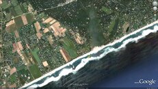
Also if you just want to pin point one location on a map rather then map the whole bottom you could use google earth. You could put a GPS in a clear waterproof box attached to a reel then send it to the surface from the location you want to map. Take those readings and mark the location on google earth and print the screen view.

Wainscott Wreck.jpg
 
I would start with a topo map, expand the mapping from a known position on land (such as a point or large rock)
 
Got a pretty good map now using topo map and photoshop. Something that I can add to as time goes on.
 
https://www.shearwater.com/products/swift/
http://cavediveflorida.com/Rum_House.htm

Back
Top Bottom