Lands’ End Newport, RI located at the end of Ledge Road off Ocean Drive east of Kings Beach near the mansions. There is no parking allowed anywhere along Ledge Road. The only way to shore dive this site is to find someone willing to drive the divers to the end of the road, unload and then go someplace else for 2 hours until it’s time to pick up the divers.
Entry and exit is a short walk down a small hill over rocks of varied sizes. Coggeshall Ledge a large rock formation about 25 yards from shore rises from the ocean bottom. The water in between the formation and the shore forms a lagoon which averages about 15fsw in depth. The eastern end can be as low as 5fsw at low tide. The lagoon is a good spot for snorkeling and newbie young divers. Diving at Lands’ End can be done without a surface swim.
Depth doesn’t exceed 30FSW anywhere I’ve ever dived here.
Current there is no current in the lagoon. The current outside the lagoon roughly follows the same pattern as Kings Beach, outgoing tide moves west, incoming tide moves east. This is one of those areas in RI that can be tricky. We normally think of outgoing tides moving in the direction of open water. Here because of the location, the east moving incoming tide may actually carry a diver towards open water. It’s a long swim to first or second beach!
Visibility in the lagoon can exceed 20 feet. There is little effect from the seas as Coggeshall ledge protects the lagoon from the ocean. So as long as divers don’t come in and stir it up which isn’t easy to do because the bottom is rocks covered with red seaweed and very little silt.
Outside the cover of the ledge visibility is subject to the conditions of the RI Sound, which are not always bad. On good days the visibility can be >20feet but, the average is 10’ with as little as 0-1’ during times of rough seas. Still the abundance of sea weed, the small amount of slit and the shallow water allowing a lot of sunlight to reach the bottom makes for some nice visibility at times.
Boat Traffic is very light, most boats don’t get too close to shore here. Beware of the occasional angler that knows the waters that one may get close! A flag and float is required by law and also by common sense at most of these sites. I always come up right under my float.
Swimming east will bring you to about 20fsw to 30fsw max. If the seas are rough you’ll feel the surge when you swim clear of the rock formation. Depth may lessen the affect. There are large rock formations rising up from the bottom that create fun swim rounds, like an underwater slalom course. The usual variety of marine life, lobsters, crabs, small fish, jellyfish, togs, stripers and blue fish can be seen here, the rest of the bottom is similar to Kings Beach, rocks weeds and sand, red seaweed being the most abundant. A change of direction to south will bring you to a long series of rock formations running perpendicular to shore and off Coggeshall Ledge (part of the ledge I think) for about 75 yds. Going around that ledge and turning west and then turning north will bring you to the west side of the lagoon. Try to find the USCG channel marker sunk at the tip of the ledge in about 20fsw. There are usually big togs lurking there and with luck you could get one to take home, a good way end a dive. If you start the dive from the west you can do the reverse and return to the east tip of the ledge.
Swimming along the shore to the east is a very pleasant, easy and scenic dive. You should feel very little current on the incoming tide, the land shields from that, the outgoing tide would push you towards the land. If you can find it there is something of a tunnel located roughly at a point that lines up with the eastern tip of the Coggeshall Ledge rock formation. The east shore is a fairly safe and easy dive. On the cliff above you is the Cliff Walk, people come from all over the world to walk the five miles of ocean view Cliff Walk provides. We New Englanders can walk on it or dive below it after a short drive!
With its calm lagoon and scenic areas open to the ocean there is something for every diver at LandsEnd.
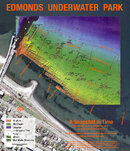
An aerial view of LandsEnd and Coggeshall ledge. Water can be seen breaking over the submerged part of the ledge running south at a right angle to the ledge.
JAMESTOWN
BEAVERTAIL STATE PARK (BST) West Passage is located at the end of Beavertail Road. After entering the park there are three parking lots on the right; each of these lots have access to the waters of the West Passage, each have more than one access and every one of those are difficult to different degrees; but they all lead to good diving! It really is up to the diver(s) to choose the spots they can handle. I don’t do any of these entries / exits anymore, maybe doing them in the first place contributed to my ruined knees!?
I included pictures but none of them really show how difficult some of these sites are to enter and exit. Since it is located close to the mouth of the bay, the surf is a consideration at these sites. Getting pounded by the waves on sharp shale rocks is no fun! Even if a diver makes it in the vis will be next to zero and the conditions may worsen during the dive making the exit more hazardous. Nice days usually equal nice diving, if you are going work you should maximize your enjoyment. Pick diving days/nights here carefully.
This sign is at the intersection with Fort Getty right after passing Mackerel Cove.
Entry/exit: this is rugged terrain; the hills can be very steep, the rocks are slippery when wet and can be sharp because a lot of the rocks are shale. There are rocks under the water at some of these sites that are waiting to trip you up.
Some entries may require divers crawl into the water or crawl backwards down shale type rocks or both. Other entries although hard climbing will lead to small protected coves that make getting into and out of the water pretty easy. The climbing will be either wearing or carrying your gear. There are also long walks because some of the paths meander making the trip longer than it should be. To say divers need to be in good shape and experienced to dive these sites is an understatement. I suggest any diver considering diving at these sites make time to check them and find the site(s) they are comfortable with diving. Not everyone will want to dive every site; some people won’t even want to get down to the water in regular clothes never mind wearing/carrying gear. These are no BS dive sites if you’re fooling yourself you will find out, do your home work!
Depth: The West Passage isn’t has deep as the East Passage, Beavertail does however share both passages; the East Passage sites will be in the Extremely Difficult section.
Forty feet of seawater is about the deepest you’ll find here, 25FSW is probably the average. Depth is not part of what makes this a black site.
Current: The current here varies from but can be very strong at times. Ike most sites diving at the slack is recommended although an hour before either slack period is easy diving, usually.
Boat Traffic: Boat traffic is usually light here. As stated earlier the water is shallow so the big ships and sailboats with deep drafts stay in the channel.