Coral Bleaching in Dampier Strait?

Please register or login

Welcome to ScubaBoard, the world's largest scuba diving community. Registration is not required to read the forums, but we encourage you to join. Joining has its benefits and enables you to participate in the discussions.

Benefits of registering include

  • Ability to post and comment on topics and discussions.
  • A Free photo gallery to share your dive photos with the world.
  • You can make this box go away

Joining is quick and easy. Log in or Register now!

Thanks for this honest report! I think I will base around Pam this time, hopefully Kri recovers in the future šŸ˜„

im heading to Pam tomorrow but have heard good things. Iā€™ll let you know

Before it gets permanently misspelled, let me correct the spelling of Fam islands, not Pam (see the Google Earth screenshot of the area, below).

One of the islands has nice look out on the top of the island and it is used to be called Penemu and later became Piaynemo for whatever reason.

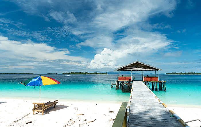
This group of islands is located to the west of Raja Ampat. One of the famous dive sites is called Melissaā€™s Garden.

IMG_5832.jpeg
 
Before it gets permanently misspelled, let me correct the spelling of Fam islands, not Pam.
Looks like there's a debate.

Wait. Isnā€™t it ā€œFamā€?

The Pam Islands are marked on most maps as ā€œFamā€, and Piaynemo is usually labelled ā€œPenemuā€ or ā€œGroot Famā€. These are foreign map makersā€™ mispronunciations of the local names for these islands. These tone-deaf renderings of the true names of their homes are the cause of some chagrin to the islandsā€™ traditional owners, so weā€™ve used the preferred local spelling here.
 
Looks like there's a debate.

@Dan

Penemu Island was originally named by the indigenous people who live there (the name refers to something akin to to "a place of discovery" or "a place of finding.").

It looks like the name was changed to Piaynemo to make the name easier for tourists to pronouce (given the popularity of the viewpoint, etc.). The locals supposedly still refer to it as Penemu.
 
The whale shark diving is not actually in Triton Bay - the fishing baggans are north west of Triton Bay in the open sea off the coast near Kaimana:

https://maps.app.goo.gl/mfAGTvRH1W4nPYtz7?g_st=com.google.maps.preview.copy

Visibility was actually quite good - pretty clear in the top 25 feet or so where we spent most of the dive!


Diving with the whale sharks (vs snorkeling) was, to me, unique in that it put you right in the thick of things. The whale sharks cruised right past at super close range and sometimes bumped you if you did not see it coming or did not get out of the way fast enough - they also seemed to like the diverā€™s bubbles and sometimes ā€œchasedā€ you a bit with mouths wide open. The one downside was that folks who went a bit deeper (most of us stayed at 10-25 feet) sent up curtains of bubbles which were a bit annoying at times.
@Joneill

Good correction on the location - I was aware that the WS location was not in Triton Bay (I've heard that trip can take up to an hour... leaving early morning to get there)

As for vis - this will always be up for debate. One person's "actually quite good" vis will be another person's "not so much..."

Look at the picture I posted - the color is untouched. That's the blue of the water (no strobes) that existed on the day (and matches what it was like our first trip as well). I've also had a couple of friends who been both to Cenderawasih and Triton Bay (WS trip - north of the resort). on an average day they claim the vis. is significantly better in Cenderawasih, and on a good day it's not close. It likely varies by season, weather patterns, so...

The tradeoff is the chance to see other marine life (dolphins, sailfish, etc.) off of Kaimana - not going to see those in Cenderawasih Bay (although we did see pilot whales on the surface in the bay).
 
It looks like the name was changed to Piaynemo to make the name easier for tourists to pronouce (given the popularity of the viewpoint, etc.). The locals supposedly still refer to it as Penemu.
That's the other way around see below for explanation of the word.

(I don't think "Piay" would make it easier for tourists than "Pe". Similarly as Peking/Beijing, Bombay/Mumbai, etc. older western map names vs. pronounced name in the local language that became the official written name)

Piaynemo​

Piaynemo is the correct local spelling of the name of the island marked on most maps of Raja Ampat as ā€œPenemuā€. Penemu is about 60km (~40 miles) west of Waisai and has a karst island seascape very similar to that of Wayag (see the photo at the top of this page).
ā€œPiaynemoā€ is a local word that describes the join between a harpoon head and shaft, and the portion of Piaynemo to the north of the islandā€™s narrowest width does indeed have the shape of a traditional harpoon head.
 
That's the other way around see below for explanation of the word.

(I don't think "Piay" would make it easier for tourists than "Pe". Similarly as Peking/Beijing, Bombay/Mumbai, etc. older western map names vs. pronounced name in the local language that became the official written name)
@Luko

Very aware of that derivation - however that doesn't make it correct ;)

You'll find several different sites each claiming the right answer. The one thing we know is true is that it was called Penemu previously, because older navigation charts referred to it as that name.

As explained by an AI chatbot:
In Bahasa Indonesia, the correct name for the island is "Pulau Piaynemo," which is sometimes also referred to as "Pulau Penemu"

If you wanted to order a local nav chart it's referred to as Pulau Penemu in several places even today.
 
To avoid confusion whether itā€™s called Piaynemo or Penemu, Pam or Fam, Burt Jones, one of Raja Ampat diving exploration pioneers add GPS coordinates to each dive sites in his book;
Diving Indonesiaā€™s Raja Ampat,
1st Edition - October 2009
ISBN 978-979-1173-06-3


You can tell how old the book is by looking at the book cover picture of Bo Windows with pillar separating the 2 windows was still intact. That pillar collapsed a few years ago.

IMG_5833.jpeg


For example on page 95, dive site Penemu 11 (Melissaā€™s Garden) in Fam Islands region, has GPS coordinates:
S 00.35.390, E 130.18.909
 
In Bahasa Indonesia, the correct name
That is not Bahasa Indonesia : in bahasa the e and the u sounds are familiar though only phonetic.
It's rather a local dialect like most possibly Betew, a derivation of the Biak language where vowels can be phonemic (long pronounced E, long pronounced U are different than short E and U ).
Something we don't have in the latin alphabet.

Fortunately you didn't mismatch the languages in front of a Melanesian Spearhead Group member. ;)

If you wanted to order a local nav chart it's referred to as Pulau Penemu in several places even today
Yes but it's like the Straits of Malacca, for the Melaka straits or the Molucca sea for Laut Maluku.
Time and maps will change, remember it's only in 1995 that Bombay was scripted as Mumbai with respect to the local marathi language.
 
That is not Bahasa Indonesia : in bahasa the e and the u sounds are familiar though only phonetic.
It's rather a local dialect like most possibly Betew, a derivation of the Biak language where vowels can be phonemic (long pronounced E, long pronounced U are different than short E and U ).
Something we don't have in the latin alphabet.

Fortunately you didn't mismatch the languages in front of a Melanesian Spearhead Group member. ;)


Yes but it's like the Straits of Malacca, for the Melaka straits or the Molucca sea for Laut Maluku.
Time and maps will change, remember it's only in 1995 that Bombay was scripted as Mumbai with respect to the local marathi language.
@Luko

All true... however you are lecturing instead of listening.

I had this conversation with the person who opened up Kri (you know who this is...).That's where I got my original answer.

All I did as a follow on was pass on the answer from ChatGPT.
 

Back
Top Bottom