Amazing weather predictions

Please register or login

Welcome to ScubaBoard, the world's largest scuba diving community. Registration is not required to read the forums, but we encourage you to join. Joining has its benefits and enables you to participate in the discussions.

Benefits of registering include

  • Ability to post and comment on topics and discussions.
  • A Free photo gallery to share your dive photos with the world.
  • You can make this box go away

Joining is quick and easy. Log in or Register now!

Doc

Was RoatanMan
Rest in Peace
Scuba Instructor
Messages
10,954
Reaction score
4,128
Location
Chicago & O'Hare heading thru TSA 5x per year
# of dives
None - Not Certified
The new technology is quite often amazing.

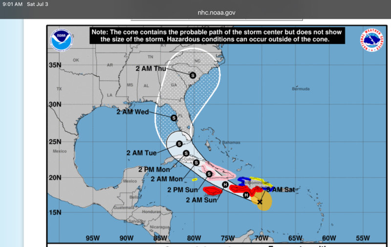
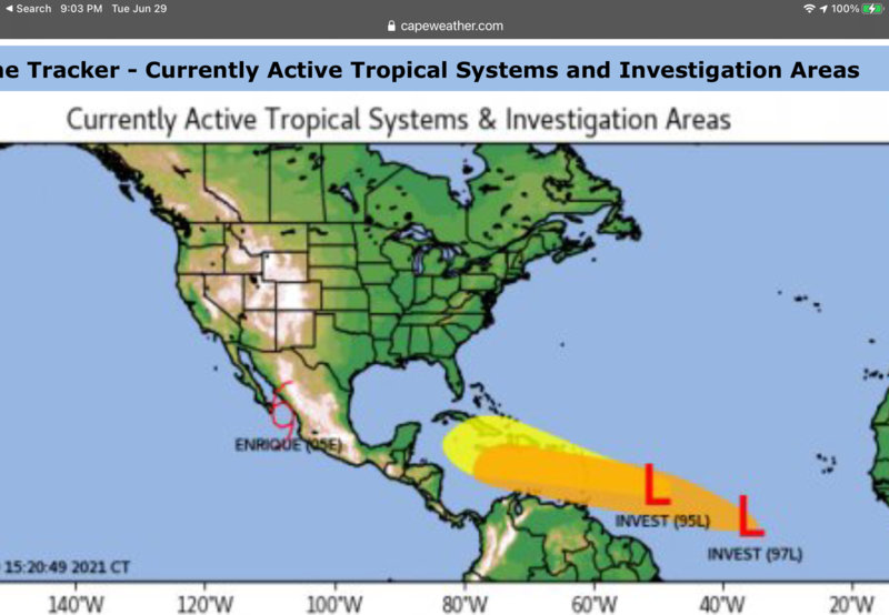
Here we see two weather maps, today’s and the predictions from 5 days previous. It doesn’t work 100%, but then again, what does?

As recently as 1998 when Hurricane Mitch bashed the Bay Islands, Mexico and Florida, we had no idea what was happening nor any indication of what that erratic SOB was going to do next. We were absolutely uninformed. Technology has jumped light years.

In the 70’s thru the 90’s we just considered Caribbean life to be ‘risky business’.


Five days go, their prediction was:
E2DCA72D-9BDD-422C-9F92-72095E9130E6.jpeg


Today, 5 days later…
8D49DEAB-E968-4E45-B95B-97CC4CEAA675.jpeg


This technology is saving lives.
 
Moore's Law.
 
The weather modeling is getting better as well as the real time data collection which is used in the models. Also it is not just one model but multiple models that are combined to give the cone of probable paths. It is also the case that one model is not the overall best model because it can model only so many factors well. Other models model other factors better. As such when combined the average out the strengths and weaknesses. Thus giving a good probabilistic prediction.
 
When i was a working oceanographer, we'd sit on a research ship out in the western North Atlantic during hurricane season, listening to marine weather forecasts. The phrase that I strongly remember -- and hated -- was "the storm has gone harmlessly out to sea." Oops! That meant we needed to batten down.....

One way the models are getting better is to take into account better the energy transfer from the ocean to the atmosphere, which is really enhanced under a storm and which depends on the temperature profiles in the upper ocean. Much better data and understanding are available today, and studies are on-going. There are an array of floats in the Gulf of Mexico right now that go up-and-down every five days to sample the ocean structure; these floats drift around with the currents but there are enough of them that some are likely in the path of a given storm. The new study is to remotely tell the floats in front of the storm to start going up-and-down faster, radioing their info home each time they reach the surface, and then to embed that new info in the models and see if it helps the storm intensity predictions. Storm path is a pretty solid forecast right now, but intensity is still the Holy Grail.
 
https://www.shearwater.com/products/swift/

Back
Top Bottom