FrankPro1
Contributor
I was surprised to see such a small turn out for Sunday Services today with forecasts showing such solid conditions. Reverend Al and two other divers were the only ones present for what looked to be from topside to be perfect conditions. Beneath the surface however, visibility was somewhat limited. At depths of more then 40ft, visibility clouded out to a murky 10ft, while in the shallows it opened up to a nice blue 15ft. After 20 minutes in the murk off the point I decided to head into the shallows of the Garden in search of Octos.
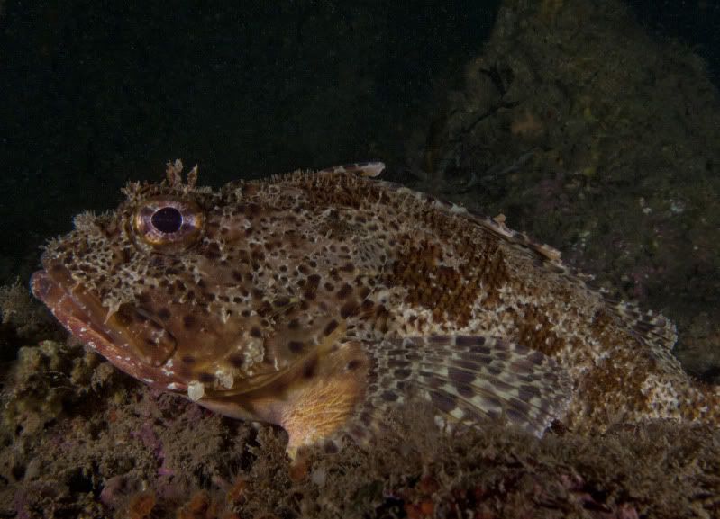
On my way into the Garden I found this big boy hanging out.
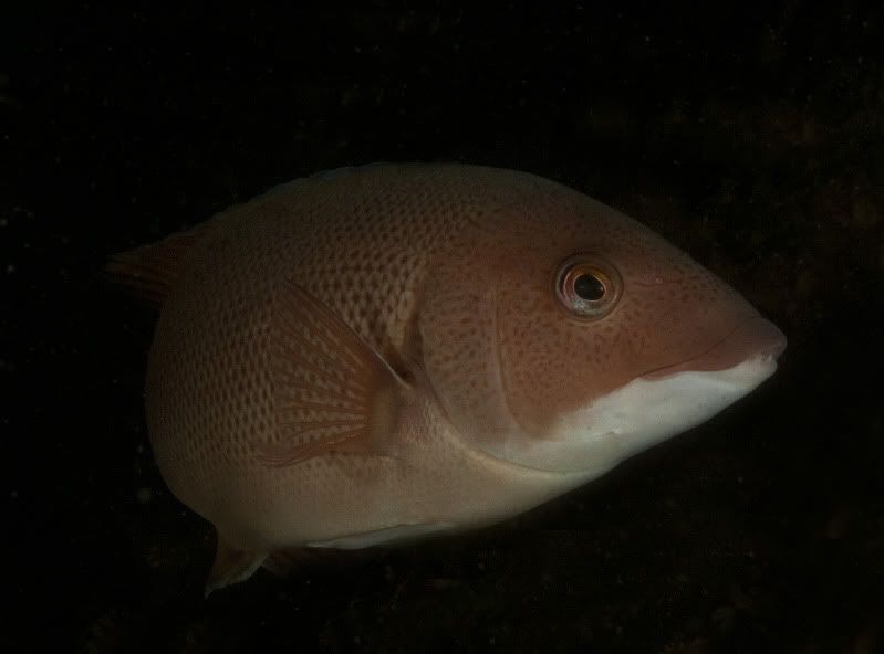
I wish females of the two-legged variety gave me this amount of attention. This female Sheephead was super inquisitive and followed me during most of my time at the Garden. Every time I stopped she would come in close and get right in my face.
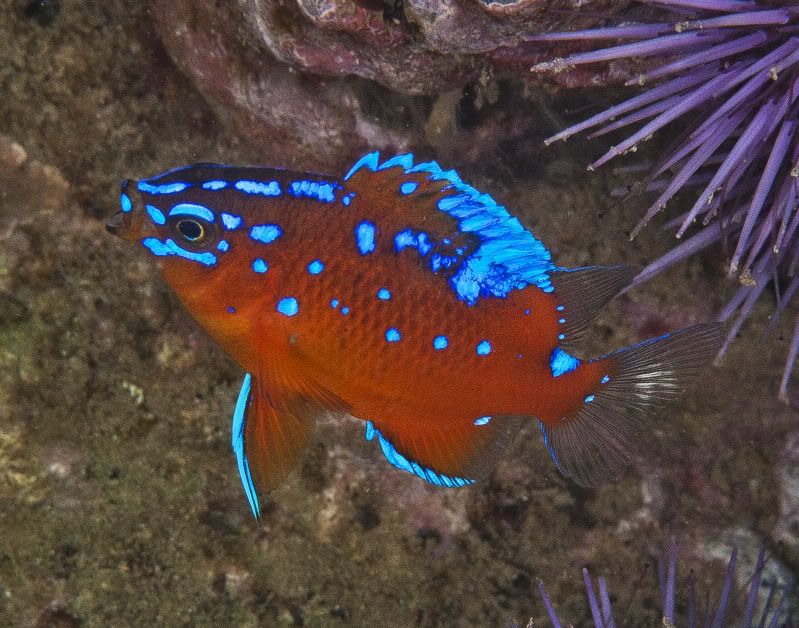
During my search for Octomom I found a few Juvenile Garibaldis.
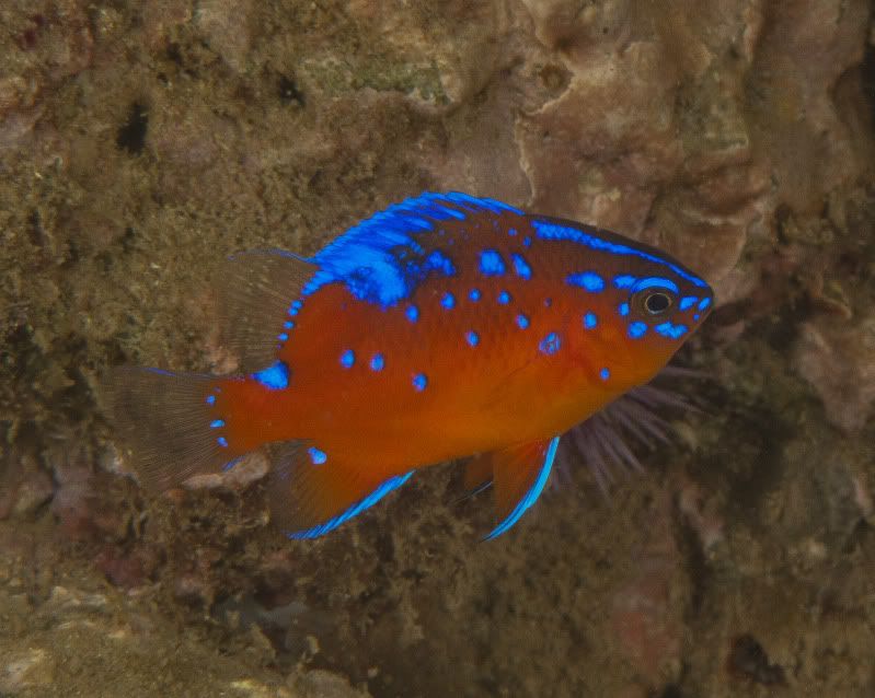
The normal casts of characters were out and about in the shallows, including many Painted Greenlings.
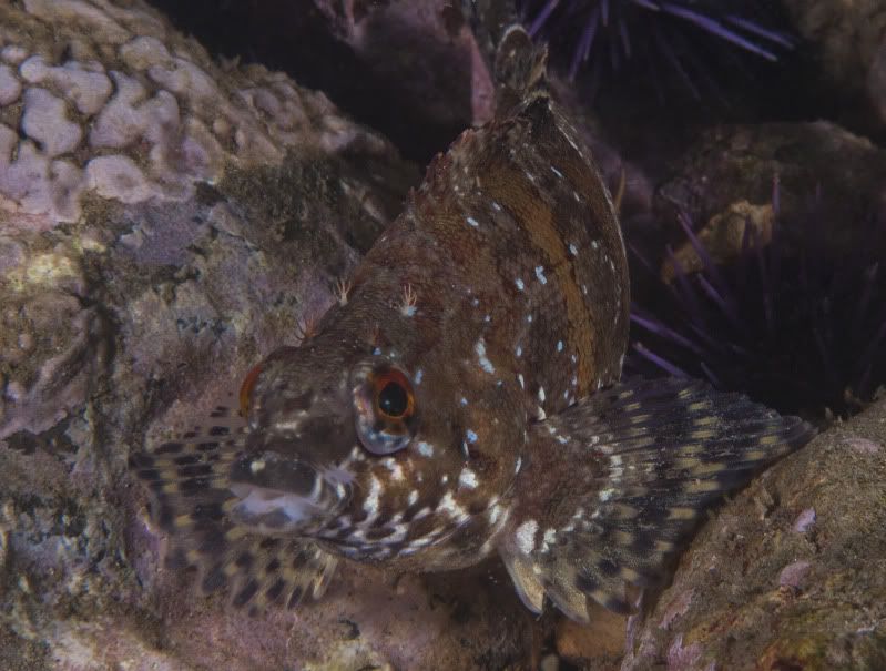
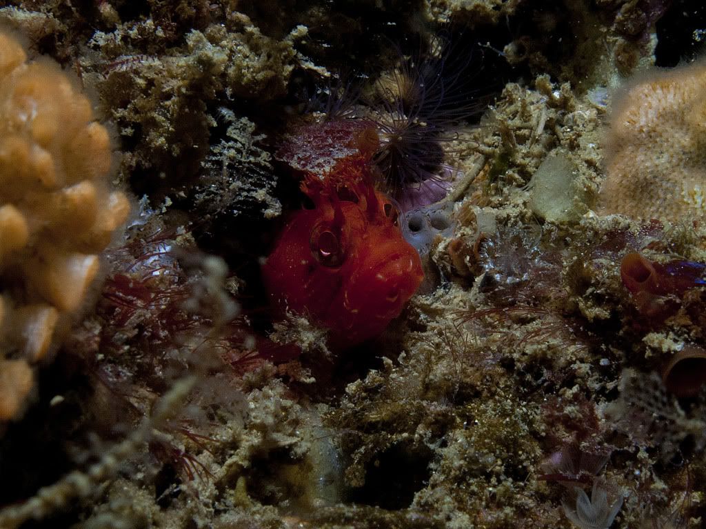
One of the oddities of the dive was this Fringehead. His head was about the size of my pinky fingernail, consequently the image is heavily cropped.
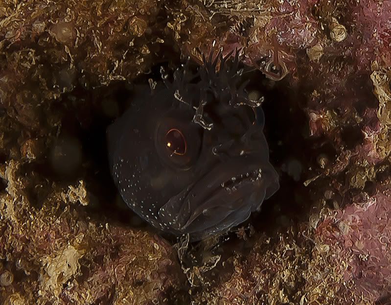
Around the 80 minute mark I found my first Octo. Unfortunately, she was a tiny specimen and only let me take one quick capture before darting into a crevice.
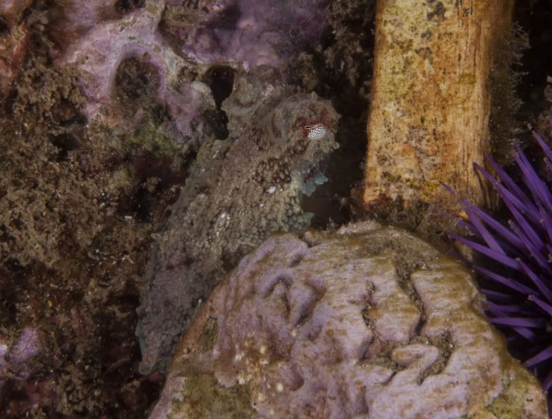
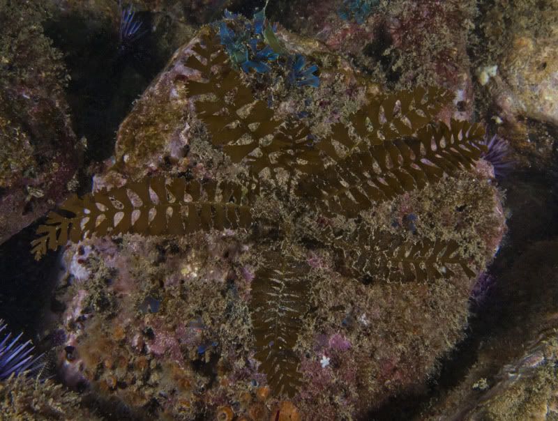
I came across this strange bit of flora in about 15ft right before I made my exit at the cove. Any idea what it is?
I surfaced after 95 much needed minutes and was greeted by tons of fisherman disregarding the MPA. There were two boats north of the point with lines in the water and one situated off the 120 reef. A group of 5 shore hook ‘n liners were scattered from cove to point. I confronted one of them on my way up the trail and in response, he told me I was wrong and that there is no closure. Reverend Al also confronted one fisherman in the parking lot who had about 5 Kelp Bass on a ringer that were obviously short “well under 10 inches”. His response was the same as the fisherman I confronted. We were wrong, he was right and that we should mind our own business. I immediately reported the incident to the DFG but doubt anything will come of it.
For those who are still uninformed:
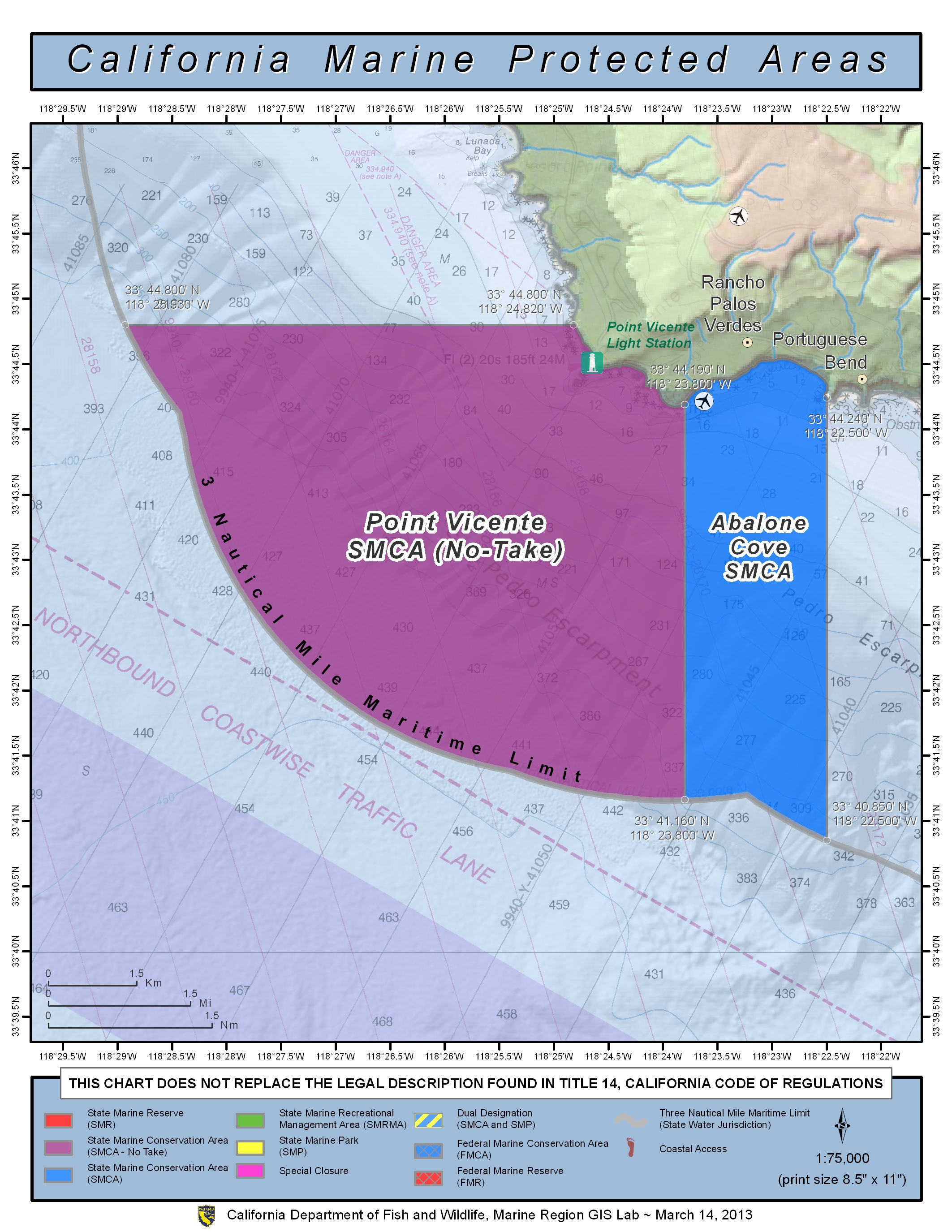
Point Vicente SMCA
Boundary: This area is bounded by the mean high tide line and straight lines connecting the following points in the order listed except where noted:
33° 44.80' N. lat. 118° 24.82' W. long.;
33° 44.80' N. lat. 118° 28.93' W. long.; thence southeastward along the three nautical mile offshore boundary to
33° 41.16' N. lat. 118° 23.80' W. long.; and
33° 44.19' N. lat. 118° 23.80' W. long.
Permitted/Prohibited Uses: Take of all living marine resources is prohibited, except for remediation activities associated with the Palos Verdes Shelf Operable Unit of the Montrose Chemical Superfund Site inside the conservation area pursuant to the Interim Record of Decision issued by the United States Environmental Protection Agency and any subsequent Records of Decision
Abalone Cove SMCA
Boundary: This area is bounded by the mean high tide line and straight lines connecting the following points in the order listed except where noted:
33° 44.19' N. lat. 118° 23.80' W. long.;
33° 41.16' N. lat. 118° 23.80' W. long.; thence southeastward along the three nautical mile offshore boundary to
33° 40.85' N. lat. 118° 22.50' W. long.; and
33° 44.24' N. lat. 118° 22.50' W. long.
Permitted/Prohibited Uses: Take of all living marine resources is prohibited except:
1. The recreational take of pelagic finfish, including Pacific bonito, and white seabass by spearfishing, and market squid by hand-held dip net is allowed.
2. The commercial take of coastal pelagic species and Pacific bonito by round haul net, and swordfish by harpoon is allowed.
3. Take pursuant to remediation activities associated with the Palos Verdes Shelf Operable Unit of the Montrose Chemical Superfund Site are allowed inside the conservation area per the Interim Record of Decision issued by the United States Environmental Protection Agency and any subsequent Records of Decision.
On my way into the Garden I found this big boy hanging out.

I wish females of the two-legged variety gave me this amount of attention. This female Sheephead was super inquisitive and followed me during most of my time at the Garden. Every time I stopped she would come in close and get right in my face.

During my search for Octomom I found a few Juvenile Garibaldis.


The normal casts of characters were out and about in the shallows, including many Painted Greenlings.

One of the oddities of the dive was this Fringehead. His head was about the size of my pinky fingernail, consequently the image is heavily cropped.

Around the 80 minute mark I found my first Octo. Unfortunately, she was a tiny specimen and only let me take one quick capture before darting into a crevice.

I came across this strange bit of flora in about 15ft right before I made my exit at the cove. Any idea what it is?

I surfaced after 95 much needed minutes and was greeted by tons of fisherman disregarding the MPA. There were two boats north of the point with lines in the water and one situated off the 120 reef. A group of 5 shore hook ‘n liners were scattered from cove to point. I confronted one of them on my way up the trail and in response, he told me I was wrong and that there is no closure. Reverend Al also confronted one fisherman in the parking lot who had about 5 Kelp Bass on a ringer that were obviously short “well under 10 inches”. His response was the same as the fisherman I confronted. We were wrong, he was right and that we should mind our own business. I immediately reported the incident to the DFG but doubt anything will come of it.

For those who are still uninformed:
Point Vicente SMCA
Boundary: This area is bounded by the mean high tide line and straight lines connecting the following points in the order listed except where noted:
33° 44.80' N. lat. 118° 24.82' W. long.;
33° 44.80' N. lat. 118° 28.93' W. long.; thence southeastward along the three nautical mile offshore boundary to
33° 41.16' N. lat. 118° 23.80' W. long.; and
33° 44.19' N. lat. 118° 23.80' W. long.
Permitted/Prohibited Uses: Take of all living marine resources is prohibited, except for remediation activities associated with the Palos Verdes Shelf Operable Unit of the Montrose Chemical Superfund Site inside the conservation area pursuant to the Interim Record of Decision issued by the United States Environmental Protection Agency and any subsequent Records of Decision
Abalone Cove SMCA
Boundary: This area is bounded by the mean high tide line and straight lines connecting the following points in the order listed except where noted:
33° 44.19' N. lat. 118° 23.80' W. long.;
33° 41.16' N. lat. 118° 23.80' W. long.; thence southeastward along the three nautical mile offshore boundary to
33° 40.85' N. lat. 118° 22.50' W. long.; and
33° 44.24' N. lat. 118° 22.50' W. long.
Permitted/Prohibited Uses: Take of all living marine resources is prohibited except:
1. The recreational take of pelagic finfish, including Pacific bonito, and white seabass by spearfishing, and market squid by hand-held dip net is allowed.
2. The commercial take of coastal pelagic species and Pacific bonito by round haul net, and swordfish by harpoon is allowed.
3. Take pursuant to remediation activities associated with the Palos Verdes Shelf Operable Unit of the Montrose Chemical Superfund Site are allowed inside the conservation area per the Interim Record of Decision issued by the United States Environmental Protection Agency and any subsequent Records of Decision.
Last edited:


