Questions about reading marine forecast

Please register or login

Welcome to ScubaBoard, the world's largest scuba diving community. Registration is not required to read the forums, but we encourage you to join. Joining has its benefits and enables you to participate in the discussions.

Benefits of registering include

  • Ability to post and comment on topics and discussions.
  • A Free photo gallery to share your dive photos with the world.
  • You can make this box go away

Joining is quick and easy. Log in or Register now!

Aerobics111

Registered
Messages
62
Reaction score
8
Location
USA
# of dives
25 - 49
New to scuba diving. Have very little idea how to read / understand marine forecast. I found this website below which seems to have a user friendly interface.

However, I'm confused by the numbers and descriptions. I attach two screenshots below.
Screen Shot 2021-12-15 at 12.03.14.png

For this one above, I put the cursor at 12-17. It shows 5-8 ft (I suppose this is wave height?) and choppy.

Screen Shot 2021-12-15 at 12.03.22.png

Then for this one above, I put the cursor at 12-21 and it shows 6-8+ ft. I'd assume it's even choppier but the description says clean.

Could anyone kindly explain this? Thanks!!!
 
A surf forecast is not necessarily the same as what you’d want for diving or boating.

I think the difference is in the wind direction making for some confused seas in the first example. In the second, the waves are about the same but more uniform.

12 and 13 second periods sound nice compared to what I usually see. Makes for more gentle swells as opposed to rough chop.
 
This one is the surf report geared towards surfing. I use the NOAA buoy website which gives you swell direction and size along with wind. I think buoy 46236 is Monterey but you can click on any in the area then click on current marine forecast and scroll all the way to the bottom and you will find Monterey Bay. You also need to know which way the beach you want to dive is facing and then apply it to the direction of the swell. So for example if there is a big west swell anything out of the bay and facing the Pacific will be blow out but sites like McAbee or Breakwater may be ok because they are protected from the west swell. To get good at reading the reports you need to actually go to the beach and see how the report affects it and after time you can just look at the report.
 
I generally prefer sites like Windy.com, for dive conditions, over that of Surfline, which is where your posting seems to have originated.

Wave conditions often vary a great deal, inside or outside of Monterey Bay; and some of those buoys, claiming the more monstrous surf, can be a significant distance, out at sea.

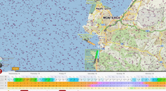
Here is the area around Monastery Beach, from a few minutes ago . . .
 

Attachments

  • Screen Shot 2021-12-15 at 12.21.48 PM.png
    Screen Shot 2021-12-15 at 12.21.48 PM.png
    480.2 KB · Views: 66
Surfers want clean swell that isn't impacted by surface winds which can cause the surface to become messy like a washing machine. They want clean swell with a decent period.

You'd be better to check boaters forecasts. Those are more relevant for divers. Now of course you can use surfing forecasts. But it just takes more interpretation.
 
I mainly use windy.com, but still check out the live beach cams before heading out.
 
Here in FL most of us use a combination of phone apps including Magicseaweed, Windfinder, Windy.app, plus buoy reading and various beach cams.
 

Back
Top Bottom