new update for humminbird side scan users

Please register or login

Welcome to ScubaBoard, the world's largest scuba diving community. Registration is not required to read the forums, but we encourage you to join. Joining has its benefits and enables you to participate in the discussions.

Benefits of registering include

  • Ability to post and comment on topics and discussions.
  • A Free photo gallery to share your dive photos with the world.
  • You can make this box go away

Joining is quick and easy. Log in or Register now!

shaggy1

Guest
Messages
47
Reaction score
3
Location
Mt Pleasant, TX
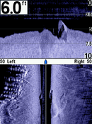
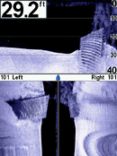
I figured I would pass this along since there seem to be several on here who use the Humminbird side immaging units. Humminbird just released a download update for their side imaging units that fix several issues and also adds a few more features. The update download can allow several cosmetic changes which is a minor plus, but the best thing is you can now split 3 different views and best of all,.... you can now view straight down with the side imaging, instead of just to the sides. I did the download and spent the better part of a day out on the lake using our 1197SI unit and I feel the new upgrades will really help with searches.
 
We did the update and found another use for our 1197C SI..... My marine enforcement guys are finding buoy anchors lost long ago... We also found a jet ski that sank about four years ago. The update was a real help in giving us added capabilities and a better chance for quicker rescue and/or recoveries.
 
I used mine the other day with great results. Really good upgrade.
 

Attachments

  • S00360.PNG
    S00360.PNG
    111.3 KB · Views: 236
  • S00391.PNG
    S00391.PNG
    118.2 KB · Views: 209
Well, just when I thought I might know something about SONAR imaging, I see a "mystery."

The first image looks like pilings on the left side of the screen similar to what we see supporting a bridge stanchion (minor change in boat travel accounts for the S shape). I have no clue what the object is that you went across but if I was going to take a WAG, I would guess you went directly over a vehicle. It certainly looks man made but I would prefer to see it on one side or another, not split down both sides in order to make a better guess.

Is the second image a submerged bridge or rail track?

I'm stumped... Fill us in... What are we looking at???

The first one is old pilings at a closed shipyard on Bayou Bonfouca. The bottom view of that is a submerged boat, or what is left of it.

The second is in the middle of the Pearl River at Logtown. It is a wooden structure that was used to offload logs from barges. When the mill closed (1925ish) this was pulled out into the river. It is 8' high, about 25' wide and approx. 140' long. I have dived on this a few years ago.

The more angles you can get the better the picture it will paint as it has to bounce back. When the boat moves a bit the picture is skewed a bit. Kinda like a polygraph, you have to interpret you picture sometimes because you can't get enough, or the proper angles to see the objects. Sometimes they are plain as day.
 
Excellent story about the bones and vehicles...good equipment description and procedure details. Thanks for the link.
 
https://www.shearwater.com/products/peregrine/

Back
Top Bottom