Mapping the Hilma Hooker

Please register or login

Welcome to ScubaBoard, the world's largest scuba diving community. Registration is not required to read the forums, but we encourage you to join. Joining has its benefits and enables you to participate in the discussions.

Benefits of registering include

  • Ability to post and comment on topics and discussions.
  • A Free photo gallery to share your dive photos with the world.
  • You can make this box go away

Joining is quick and easy. Log in or Register now!

DiveNav

ScubaBoard Supporter
Scuba Instructor
Messages
3,889
Reaction score
488
Location
Southern California
# of dives
200 - 499
Hi,
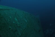
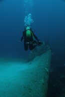
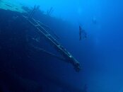
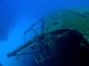
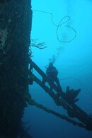
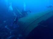
last year we added the C-53 (the only wreck in Cozumel) to our dive simulator and this year we want to add the Hilma Hooker.

Which dive operator in Bonaire does offer dives on the Hilma Hooker? Who is the local expert for the ship?

Thanks

AM
 
Most of the dive ops seem to go to the Hooker. That said, it's also a fairly easy shore dive. The ship, about 230 ft long, lies on its starboard side in about 95 ft. of water, parallel to the shore, on a sand channel in a double reef system. The port rail is about 60 ft. deep. Three buoys mark the site. Left to right as seen from shore they are: left buoy (south) is at the bow; center buoy is at the edge of the reef amidships; right buoy (north) is at the stern. The mainmast extends across the sand channel to the base of the outer reef. The ship is pretty much a stock Liberty Ship from WW II. The holds are open with the hatch covers down on the sand channel floor. The bridge and superstructure have been crunched a bit, with a lot of sprung and cracked plates, but mostly intact. Penetration is possible, though not encouraged.

There are a lot of embellished stories about how the ship was sunk in 1984. Your best source for a formal study might be to contact STINAPA the National Park entity managing the marine parks of Bonaire:

STINAPA Bonaire - National Parks Foundation

If you really want to run the project off a dive boat, I would suggest hiring an operator to do it. This would probably prompt greater cooperation from the Marine Preserve people if you have a local DM present for your project.

Attached are some pictures to give you an idea of what the site looks like. Vis is usually best in the late summer early fall.
 

Attachments

  • Hooker_amidships_facing stern.jpg
    Hooker_amidships_facing stern.jpg
    138.7 KB · Views: 164
  • Hooker_facing stern.jpg
    Hooker_facing stern.jpg
    145.8 KB · Views: 194
  • Hooker_lokig to bow.jpg
    Hooker_lokig to bow.jpg
    147 KB · Views: 143
  • Hooker_looking astern.jpg
    Hooker_looking astern.jpg
    207.7 KB · Views: 243
  • Hooker_Mainmast.jpg
    Hooker_Mainmast.jpg
    186.7 KB · Views: 140
  • Hooker_Propulsion_Rudder.jpg
    Hooker_Propulsion_Rudder.jpg
    226.8 KB · Views: 161
  • Hooker_stern.jpg
    Hooker_stern.jpg
    160.8 KB · Views: 187
If I were doing it, I would just shore dive it. No need to be hampered by dive op imposed time limits. It's a fairly easy shore dive. If you want/need some technical gear like big tanks or a rebreather then I would call Walt at Rectec but otherwise pretty much any dive op can take you.
 
It's an easy shore dive only problem I could see is getting in/out of the surf with doubles and stages but not the bad. This way you don't have to worry about someone else schedule.
 
Trick on the shore dive is swim out to the FAR buoy (to your right, as you swim out)(there are 3 buoys). Just snorkel out to save air. From there, descend the line to the bottom. From there, you can make your way up the hull (it's on it's starboard side, at an angle, almost upside down). From there, simply make your way around the bow, back down the line to the prop. Lots of sponge growth (Town Pier and Salt Pier are better, IMO). Not as many fish as I thought there'd be.

It is very helpfull to take lights, as you can peer down (up) into the hold.

Yes, the dive boats do go there, but I have to agree it's a pretty simple shore dive, really.
 
Shore dive - best option. No guide necessary. No good maps or diagrams of the wreck of which I am aware. Walt at RecTec is likely the best resource for info and detail. A good dive simulator of the Hilma is likely marketable.
 
Shore dive - best option. No guide necessary. No good maps or diagrams of the wreck of which I am aware. Walt at RecTec is likely the best resource for info and detail. A good dive simulator of the Hilma is likely marketable.

Thank You.

How do I get hold of "Walt at RecTec"?

AM
 
Walter is simple www.rectekscuba.com However - before you begin a commercial venture perhaps you should also coordinate with STINAPA www.bmp.org since the Hilma Hooker lies within their national park jurisdiction. I'm sure that Walter can set you straight on that too.

I don't know what kind of photographic equipment you will need to create a series of images to make an accurate virtual dive program but I'm sure it's a lot. The shoreline is a bit rugged for hauling heavy gear in and out and the wreck is quite a ways off-shore. You might also want to coordinate with Walter or STINAPA to charter a boat.

Another Bonaire wreck that you may find lucrative is the Maria Bahn (Windjammer.)
 

Back
Top Bottom