- Messages
- 54,448
- Reaction score
- 8,551
- # of dives
- 500 - 999
From Tropical Weather : Weather Underground
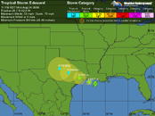
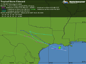
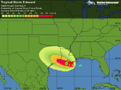
Tropical Storm Edouard is intensifying as it approaches landfall Tuesday morning along the Texas/Louisiana border. Visible satellite loops show Edouard's heavy thunderstorm activity has increased significantly in the past few hours, and is now starting to wrap all the way around the storm. Long range radar out of Lake Charles, Louisiana also shows an increase in the organization and intensity of the radar echoes. Edouard is over ocean waters of about 29°C, which extend to a moderate depth. The Tropical Cyclone Heat Potential, a measure of the total energy available for rapid intensification, is about 30 kJ/cm^2, which is less than the value of 80 typically associated with rapid intensification. Wind shear has fallen from about 10 knots last night to 5 knots this afternoon, which has allowed the storm to organize. A new hurricane hunter plane entered the storm at about 2pm EDT, and so far has measured top winds of 50 knots (57 mph) at the surface with its SFMR instrument.
Could this make hurricane status...?


