Can anyone tell me about diving Port Orchard?

Please register or login

Welcome to ScubaBoard, the world's largest scuba diving community. Registration is not required to read the forums, but we encourage you to join. Joining has its benefits and enables you to participate in the discussions.

Benefits of registering include

  • Ability to post and comment on topics and discussions.
  • A Free photo gallery to share your dive photos with the world.
  • You can make this box go away

Joining is quick and easy. Log in or Register now!

Cthippo

Contributor
Messages
1,092
Reaction score
1,419
Location
Bellingham WA
# of dives
25 - 49
Looking at dives i want to do this summer, there are three wrecks in port orchard I would like to poke. Two are down in the Gilberton area and a really interesting looking one up near Manzanita. Can anyone tell me about diving in this area as far as visibility, currents, etc? Anybody in the area want to go take a look for them?
 
Reach out to Ashley Arnold on FB as she lives there (very good instructor too).

Also reach out to Kevin Parkhurst on FB as he's been diving a loooooong time and is a great source of info.

Tell both I referred you.
 
Winter is better, that area of Port Orchard (the waterbody not the town) has insane boat traffic and it churns up the vis.
 
Winter is better, that area of Port Orchard (the waterbody not the town) has insane boat traffic and it churns up the vis.
That sounds like a recurrent theme in Puget Sound. If it's not the boats it's the alge. For best results, be miserable :p
 
There's a fish farm, a marina, and it's a major corridor via Agate pass to everywhere north and south so the sailboat traffic is mostly concentrated around slack. I'm not seeing anything on the multibeam data in those areas, not saying they don't exist, but its a long way to come to see a sunken rowboat, swimfloat, or boat lift.
 
Do you have the AWOIS / ENC data on your computer? I am working off that verified with the multi beam. I can send you the AWOIS/ENC IDs or coords for the wrecks in question when I can get enough Internet for my laptop to work.
 
Do you have the AWOIS / ENC data on your computer? I am working off that verified with the multi beam. I can send you the AWOIS/ENC IDs or coords for the wrecks in question when I can get enough Internet for my laptop to work.
the AWOIS is next to useless and hopelessly out of date. I have the multibeam for that area
 
the AWOIS is next to useless and hopelessly out of date. I have the multibeam for that area
I agree with you sometimes, but other times it is useful.

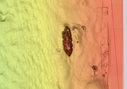
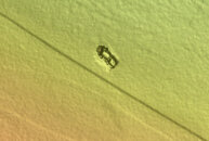
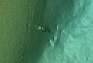
The three Port Orchard wrecks I am looking at are...

Hidden Cove Wreck.jpg
47.691056, -122.567528
Approximate length 27.77m, width 6.85m, height off bottom 5.0m. Depth 8.5 meters
This is by far the most interesting one

54099 -.jpg
47.639722, -122.597917
9.03M X 3.54M WITH HT OF 1.6M ABOVE SEAFLOOR Depth 7.4 meters
Probably just another sunken Bayliner, but hey, if I've driven all the way down to do the first one...

54100.jpg
47.625333, -122.590778
9.76M X 3.68M, 4.76 M ABOVE SEAFLOOR Depth 25.3 meters
Another probably innocous wreck, but at 80 feet. Have to think about this one a little harder.
 
oh no wonder I didnt see the Manzinita one, its way north of what I envisioned. The only one that is "easy" current and boat traffic wise is the middle one
 
https://www.shearwater.com/products/swift/

Back
Top Bottom