All of the dive sites of Roatan available on google maps

Please register or login

Welcome to ScubaBoard, the world's largest scuba diving community. Registration is not required to read the forums, but we encourage you to join. Joining has its benefits and enables you to participate in the discussions.

Benefits of registering include

  • Ability to post and comment on topics and discussions.
  • A Free photo gallery to share your dive photos with the world.
  • You can make this box go away

Joining is quick and easy. Log in or Register now!

Roatan Marine Park

Registered
Messages
63
Reaction score
16
Location
West End, Roatan, Honduras
# of dives
5000 - ∞
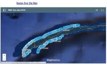
With so many new moorings being introduced each year, it's hard for people to keep up to date with all the new dive sites. Please follow the link to access the file, and if you are interested in naming your own dive site, we are here to assist.
https://www.roatanmarinepark.org/marine-infrastructure
 

Attachments

  • s.jpg
    s.jpg
    48.1 KB · Views: 264
That is cool. Now to update my log with GPS coordinates: I only have them for two or three sites where those were available at the time.
 
Anyone have an updated link to this?
 
Anyone have an updated link to this?
I don't know if it's the same one or not (looks similar, at least) but I found this one embedded on a web site of one of the dive shops in West Bay some time ago.

Full credit to whoever created it:

RMP dive sites

The one that I used to update Subsurface after my last trip was this one:

Roatan online dive site map

Haven't compared them for accuracy. Paraphrasing an old saying about watches, it is possible that a man with two maps might not know where anything is...

Hope that helps.
 
I have found these two links but thank you! I was searching for something I could integrate with Google Earth for easier viewing on iPhone.
 
I have found these two links but thank you! I was searching for something I could integrate with Google Earth for easier viewing on iPhone.
Good idea! I haven't done any Google Earth work in a few years, but that idea intrigued me...

That first link, at least on my Chrome browse in Windows 11, gave me a couple of options in its "More" menu that seem to work for that:
1728319229326.png

With "View map in Google Earth", grabbing the original link in the browser before Chrome "redirects" it a bit and copying it to my iPhone, opened it up in my (newly installed) Google Earth app.

Also tried downloading the KML file, sending that to my iPhone via WhatApp, and then opening that up in Google Earth on the phone (and saving it as a local file to be less dependent on an internet connection when viewing it). It worked with my phone in airplane mode but the little diver icon appears as a blue square with a black X in it instead:

1728319634700.jpeg


Local KML file has the advantage that you could manipulate it if you had the inclination and the ability...

Maybe you can try something like that for what you are looking for.
 
Oh how cool! The magic of right click ;-) I'll give this a try as it sounds like that would address my need. Thanks for the idea.
 

Back
Top Bottom