DevonDiver
N/A
http://www.usno.navy.mil/NOOC/nmfc-ph/RSS/jtwc/warnings/wp0411web.txt
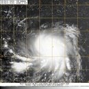
WTPN31 PGTW 220900 MSGID/GENADMIN/NAVMARFCSTCEN PEARL HARBOR HI/JTWC// SUBJ/TROPICAL CYCLONE WARNING// RMKS/ 1. TROPICAL STORM 04W (SONGDA) WARNING NR 009 01 ACTIVE TROPICAL CYCLONE IN NORTHWESTPAC MAX SUSTAINED WINDS BASED ON ONE-MINUTE AVERAGE WIND RADII VALID OVER OPEN WATER ONLY --- WARNING POSITION: 220600Z --- NEAR 10.0N 136.4E MOVEMENT PAST SIX HOURS - 290 DEGREES AT 05 KTS POSITION ACCURATE TO WITHIN 060 NM POSITION BASED ON CENTER LOCATED BY SATELLITE PRESENT WIND DISTRIBUTION: MAX SUSTAINED WINDS - 045 KT, GUSTS 055 KT WIND RADII VALID OVER OPEN WATER ONLY RADIUS OF 034 KT WINDS - 060 NM NORTHEAST QUADRANT 050 NM SOUTHEAST QUADRANT 050 NM SOUTHWEST QUADRANT 060 NM NORTHWEST QUADRANT REPEAT POSIT: 10.0N 136.4E --- FORECASTS: 12 HRS, VALID AT: 221800Z --- 10.6N 135.0E MAX SUSTAINED WINDS - 055 KT, GUSTS 070 KT WIND RADII VALID OVER OPEN WATER ONLY RADIUS OF 050 KT WINDS - 025 NM NORTHEAST QUADRANT 025 NM SOUTHEAST QUADRANT 025 NM SOUTHWEST QUADRANT 025 NM NORTHWEST QUADRANT RADIUS OF 034 KT WINDS - 090 NM NORTHEAST QUADRANT 075 NM SOUTHEAST QUADRANT 080 NM SOUTHWEST QUADRANT 090 NM NORTHWEST QUADRANT VECTOR TO 24 HR POSIT: 290 DEG/ 07 KTS --- 24 HRS, VALID AT: 230600Z --- 11.0N 133.7E MAX SUSTAINED WINDS - 065 KT, GUSTS 080 KT WIND RADII VALID OVER OPEN WATER ONLY RADIUS OF 050 KT WINDS - 040 NM NORTHEAST QUADRANT 035 NM SOUTHEAST QUADRANT 035 NM SOUTHWEST QUADRANT 040 NM NORTHWEST QUADRANT RADIUS OF 034 KT WINDS - 105 NM NORTHEAST QUADRANT 095 NM SOUTHEAST QUADRANT 095 NM SOUTHWEST QUADRANT 110 NM NORTHWEST QUADRANT VECTOR TO 36 HR POSIT: 290 DEG/ 07 KTS --- 36 HRS, VALID AT: 231800Z --- 11.4N 132.4E MAX SUSTAINED WINDS - 075 KT, GUSTS 090 KT WIND RADII VALID OVER OPEN WATER ONLY RADIUS OF 064 KT WINDS - 025 NM NORTHEAST QUADRANT 025 NM SOUTHEAST QUADRANT 025 NM SOUTHWEST QUADRANT 025 NM NORTHWEST QUADRANT RADIUS OF 050 KT WINDS - 050 NM NORTHEAST QUADRANT 045 NM SOUTHEAST QUADRANT 045 NM SOUTHWEST QUADRANT 050 NM NORTHWEST QUADRANT RADIUS OF 034 KT WINDS - 115 NM NORTHEAST QUADRANT 105 NM SOUTHEAST QUADRANT 110 NM SOUTHWEST QUADRANT 120 NM NORTHWEST QUADRANT VECTOR TO 48 HR POSIT: 290 DEG/ 07 KTS --- EXTENDED OUTLOOK: 48 HRS, VALID AT: 240600Z --- 11.9N 131.1E MAX SUSTAINED WINDS - 085 KT, GUSTS 105 KT WIND RADII VALID OVER OPEN WATER ONLY RADIUS OF 064 KT WINDS - 035 NM NORTHEAST QUADRANT 030 NM SOUTHEAST QUADRANT 030 NM SOUTHWEST QUADRANT 035 NM NORTHWEST QUADRANT RADIUS OF 050 KT WINDS - 055 NM NORTHEAST QUADRANT 055 NM SOUTHEAST QUADRANT 055 NM SOUTHWEST QUADRANT 055 NM NORTHWEST QUADRANT RADIUS OF 034 KT WINDS - 125 NM NORTHEAST QUADRANT 115 NM SOUTHEAST QUADRANT 115 NM SOUTHWEST QUADRANT 125 NM NORTHWEST QUADRANT VECTOR TO 72 HR POSIT: 295 DEG/ 07 KTS --- 72 HRS, VALID AT: 250600Z --- 13.1N 128.6E MAX SUSTAINED WINDS - 100 KT, GUSTS 125 KT WIND RADII VALID OVER OPEN WATER ONLY RADIUS OF 064 KT WINDS - 040 NM NORTHEAST QUADRANT 040 NM SOUTHEAST QUADRANT 040 NM SOUTHWEST QUADRANT 040 NM NORTHWEST QUADRANT RADIUS OF 050 KT WINDS - 065 NM NORTHEAST QUADRANT 060 NM SOUTHEAST QUADRANT 060 NM SOUTHWEST QUADRANT 065 NM NORTHWEST QUADRANT RADIUS OF 034 KT WINDS - 130 NM NORTHEAST QUADRANT 120 NM SOUTHEAST QUADRANT 120 NM SOUTHWEST QUADRANT 125 NM NORTHWEST QUADRANT VECTOR TO 96 HR POSIT: 310 DEG/ 08 KTS --- LONG RANGE OUTLOOK: NOTE...ERRORS FOR TRACK HAVE AVERAGED NEAR 250 NM ON DAY 4 AND 350 NM ON DAY 5... AND FOR INTENSITY NEAR 20 KT EACH DAY. --- 96 HRS, VALID AT: 260600Z --- 15.1N 126.2E MAX SUSTAINED WINDS - 110 KT, GUSTS 135 KT WIND RADII VALID OVER OPEN WATER ONLY VECTOR TO 120 HR POSIT: 320 DEG/ 09 KTS --- 120 HRS, VALID AT: 270600Z --- 17.9N 123.7E MAX SUSTAINED WINDS - 115 KT, GUSTS 140 KT WIND RADII VALID OVER OPEN WATER ONLY --- REMARKS: 220900Z POSITION NEAR 10.2N 136.1E. TROPICAL STORM (TS) 04W (SONGDA), LOCATED APPROXIMATELY 190 NM NORTH-NORTHEAST OF PALAU, HAS TRACKED WEST-NORTHWESTWARD AT 05 KNOTS OVER THE PAST SIX HOURS. ANIMATED MULTISPECTRAL SATELLITE IMAGERY (MSI) DEPICTS TIGHTLY CURVED CONVECTIVE BANDING WRAPPING INTO A CONSOLIDATING LOW LEVEL CIRCULATION CENTER WITH DEEP CONVECTION CONTINUING TO BUILD OVER THE CENTER. THE CURRENT POSITION IS BASED ON THE 22/06Z PGTW SATELLITE ANALYSIS FIX AND INTERPOLATED FROM MSI WITH FAIR CONFIDENCE. THE CURRENT INTENSITY IS BASED ON DVORAK ESTIMATES FROM KNES, RJTD, AND PGTW RANGING FROM 45 TO 55 KNOTS. RECENT OBSERVATIONS FROM YAP AND PALAU, JUST EAST AND SOUTHWEST OF THE SYSTEM RESPECTIVELY, AS WELL AS THE OVERALL STRUCTURE IN RECENT MICROWAVE IMAGERY (220446Z AMSRE) SUPPORT AN INTENSITY AT THE LOWER END OF THIS RANGE. UPPER LEVEL ANALYSIS INDICATES THAT THE SYSTEM IS LOCATED IN A REGION OF STRONGLY DIFFLUENT FLOW ALOFT AND LOW (10-15 KNOTS) VERTICAL WIND SHEAR (VWS). ANIMATED WATER VAPOR IMAGERY SHOWS GOOD EQUATORWARD OUTFLOW, WHILE POLEWARD OUTFLOW (THOUGH IMPROVING), REMAINS SOMEWHAT LIMITED. TS SONGDA IS CURRENTLY STEERING ALONG THE SOUTHWESTERN PERIPHERY OF A MID-LEVEL SUBTROPICAL RIDGE (STR) AND IS EXPECTED TO SLOWLY TRACK GENERALLY WEST-NORTHWESTWARD THROUGH TAU 48, BEFORE BEGINNING TO TURN POLEWARD AS AN APPROACHING SHORTWAVE TROUGH BEGINS TO WEAKEN THE WESTERN EXTENT OF THE STR. THE SYSTEM IS FORECAST TO STEADILY INTENSIFY THROUGHOUT THE FORECAST AS IT CONTINUES TO TRACK OVER FAVORABLE SEA SURFACE TEMPERATURES AND WITHIN AN IMPROVING UPPER LEVEL ENVIRONMENT. NUMERICAL MODEL GUIDANCE REMAINS IN FAIR AGREEMENT, WITH THE EXCEPTION OF GFS AND GFDN, WHICH ARE AT THE OUTER EXTENTS OF THE AIDS ENVELOPE, BUT HAVE TRENDED TOWARDS CONSENSUS OVER THE PAST 12 HOURS. THIS FORECAST REMAINS CLOSE TO MODEL CONSENSUS (FAVORING ECMWF, NOGAPS, WBAR, AND EGRR) AND IS CONSISTENT WITH THE PREVIOUS FORECAST TRACK. MAXIMUM SIGNIFICANT WAVE HEIGHT AT 220600Z IS 15 FEET. NEXT WARNINGS AT 221500Z, 222100Z, 230300Z AND 230900Z.// NNNN

WTPN31 PGTW 220900 MSGID/GENADMIN/NAVMARFCSTCEN PEARL HARBOR HI/JTWC// SUBJ/TROPICAL CYCLONE WARNING// RMKS/ 1. TROPICAL STORM 04W (SONGDA) WARNING NR 009 01 ACTIVE TROPICAL CYCLONE IN NORTHWESTPAC MAX SUSTAINED WINDS BASED ON ONE-MINUTE AVERAGE WIND RADII VALID OVER OPEN WATER ONLY --- WARNING POSITION: 220600Z --- NEAR 10.0N 136.4E MOVEMENT PAST SIX HOURS - 290 DEGREES AT 05 KTS POSITION ACCURATE TO WITHIN 060 NM POSITION BASED ON CENTER LOCATED BY SATELLITE PRESENT WIND DISTRIBUTION: MAX SUSTAINED WINDS - 045 KT, GUSTS 055 KT WIND RADII VALID OVER OPEN WATER ONLY RADIUS OF 034 KT WINDS - 060 NM NORTHEAST QUADRANT 050 NM SOUTHEAST QUADRANT 050 NM SOUTHWEST QUADRANT 060 NM NORTHWEST QUADRANT REPEAT POSIT: 10.0N 136.4E --- FORECASTS: 12 HRS, VALID AT: 221800Z --- 10.6N 135.0E MAX SUSTAINED WINDS - 055 KT, GUSTS 070 KT WIND RADII VALID OVER OPEN WATER ONLY RADIUS OF 050 KT WINDS - 025 NM NORTHEAST QUADRANT 025 NM SOUTHEAST QUADRANT 025 NM SOUTHWEST QUADRANT 025 NM NORTHWEST QUADRANT RADIUS OF 034 KT WINDS - 090 NM NORTHEAST QUADRANT 075 NM SOUTHEAST QUADRANT 080 NM SOUTHWEST QUADRANT 090 NM NORTHWEST QUADRANT VECTOR TO 24 HR POSIT: 290 DEG/ 07 KTS --- 24 HRS, VALID AT: 230600Z --- 11.0N 133.7E MAX SUSTAINED WINDS - 065 KT, GUSTS 080 KT WIND RADII VALID OVER OPEN WATER ONLY RADIUS OF 050 KT WINDS - 040 NM NORTHEAST QUADRANT 035 NM SOUTHEAST QUADRANT 035 NM SOUTHWEST QUADRANT 040 NM NORTHWEST QUADRANT RADIUS OF 034 KT WINDS - 105 NM NORTHEAST QUADRANT 095 NM SOUTHEAST QUADRANT 095 NM SOUTHWEST QUADRANT 110 NM NORTHWEST QUADRANT VECTOR TO 36 HR POSIT: 290 DEG/ 07 KTS --- 36 HRS, VALID AT: 231800Z --- 11.4N 132.4E MAX SUSTAINED WINDS - 075 KT, GUSTS 090 KT WIND RADII VALID OVER OPEN WATER ONLY RADIUS OF 064 KT WINDS - 025 NM NORTHEAST QUADRANT 025 NM SOUTHEAST QUADRANT 025 NM SOUTHWEST QUADRANT 025 NM NORTHWEST QUADRANT RADIUS OF 050 KT WINDS - 050 NM NORTHEAST QUADRANT 045 NM SOUTHEAST QUADRANT 045 NM SOUTHWEST QUADRANT 050 NM NORTHWEST QUADRANT RADIUS OF 034 KT WINDS - 115 NM NORTHEAST QUADRANT 105 NM SOUTHEAST QUADRANT 110 NM SOUTHWEST QUADRANT 120 NM NORTHWEST QUADRANT VECTOR TO 48 HR POSIT: 290 DEG/ 07 KTS --- EXTENDED OUTLOOK: 48 HRS, VALID AT: 240600Z --- 11.9N 131.1E MAX SUSTAINED WINDS - 085 KT, GUSTS 105 KT WIND RADII VALID OVER OPEN WATER ONLY RADIUS OF 064 KT WINDS - 035 NM NORTHEAST QUADRANT 030 NM SOUTHEAST QUADRANT 030 NM SOUTHWEST QUADRANT 035 NM NORTHWEST QUADRANT RADIUS OF 050 KT WINDS - 055 NM NORTHEAST QUADRANT 055 NM SOUTHEAST QUADRANT 055 NM SOUTHWEST QUADRANT 055 NM NORTHWEST QUADRANT RADIUS OF 034 KT WINDS - 125 NM NORTHEAST QUADRANT 115 NM SOUTHEAST QUADRANT 115 NM SOUTHWEST QUADRANT 125 NM NORTHWEST QUADRANT VECTOR TO 72 HR POSIT: 295 DEG/ 07 KTS --- 72 HRS, VALID AT: 250600Z --- 13.1N 128.6E MAX SUSTAINED WINDS - 100 KT, GUSTS 125 KT WIND RADII VALID OVER OPEN WATER ONLY RADIUS OF 064 KT WINDS - 040 NM NORTHEAST QUADRANT 040 NM SOUTHEAST QUADRANT 040 NM SOUTHWEST QUADRANT 040 NM NORTHWEST QUADRANT RADIUS OF 050 KT WINDS - 065 NM NORTHEAST QUADRANT 060 NM SOUTHEAST QUADRANT 060 NM SOUTHWEST QUADRANT 065 NM NORTHWEST QUADRANT RADIUS OF 034 KT WINDS - 130 NM NORTHEAST QUADRANT 120 NM SOUTHEAST QUADRANT 120 NM SOUTHWEST QUADRANT 125 NM NORTHWEST QUADRANT VECTOR TO 96 HR POSIT: 310 DEG/ 08 KTS --- LONG RANGE OUTLOOK: NOTE...ERRORS FOR TRACK HAVE AVERAGED NEAR 250 NM ON DAY 4 AND 350 NM ON DAY 5... AND FOR INTENSITY NEAR 20 KT EACH DAY. --- 96 HRS, VALID AT: 260600Z --- 15.1N 126.2E MAX SUSTAINED WINDS - 110 KT, GUSTS 135 KT WIND RADII VALID OVER OPEN WATER ONLY VECTOR TO 120 HR POSIT: 320 DEG/ 09 KTS --- 120 HRS, VALID AT: 270600Z --- 17.9N 123.7E MAX SUSTAINED WINDS - 115 KT, GUSTS 140 KT WIND RADII VALID OVER OPEN WATER ONLY --- REMARKS: 220900Z POSITION NEAR 10.2N 136.1E. TROPICAL STORM (TS) 04W (SONGDA), LOCATED APPROXIMATELY 190 NM NORTH-NORTHEAST OF PALAU, HAS TRACKED WEST-NORTHWESTWARD AT 05 KNOTS OVER THE PAST SIX HOURS. ANIMATED MULTISPECTRAL SATELLITE IMAGERY (MSI) DEPICTS TIGHTLY CURVED CONVECTIVE BANDING WRAPPING INTO A CONSOLIDATING LOW LEVEL CIRCULATION CENTER WITH DEEP CONVECTION CONTINUING TO BUILD OVER THE CENTER. THE CURRENT POSITION IS BASED ON THE 22/06Z PGTW SATELLITE ANALYSIS FIX AND INTERPOLATED FROM MSI WITH FAIR CONFIDENCE. THE CURRENT INTENSITY IS BASED ON DVORAK ESTIMATES FROM KNES, RJTD, AND PGTW RANGING FROM 45 TO 55 KNOTS. RECENT OBSERVATIONS FROM YAP AND PALAU, JUST EAST AND SOUTHWEST OF THE SYSTEM RESPECTIVELY, AS WELL AS THE OVERALL STRUCTURE IN RECENT MICROWAVE IMAGERY (220446Z AMSRE) SUPPORT AN INTENSITY AT THE LOWER END OF THIS RANGE. UPPER LEVEL ANALYSIS INDICATES THAT THE SYSTEM IS LOCATED IN A REGION OF STRONGLY DIFFLUENT FLOW ALOFT AND LOW (10-15 KNOTS) VERTICAL WIND SHEAR (VWS). ANIMATED WATER VAPOR IMAGERY SHOWS GOOD EQUATORWARD OUTFLOW, WHILE POLEWARD OUTFLOW (THOUGH IMPROVING), REMAINS SOMEWHAT LIMITED. TS SONGDA IS CURRENTLY STEERING ALONG THE SOUTHWESTERN PERIPHERY OF A MID-LEVEL SUBTROPICAL RIDGE (STR) AND IS EXPECTED TO SLOWLY TRACK GENERALLY WEST-NORTHWESTWARD THROUGH TAU 48, BEFORE BEGINNING TO TURN POLEWARD AS AN APPROACHING SHORTWAVE TROUGH BEGINS TO WEAKEN THE WESTERN EXTENT OF THE STR. THE SYSTEM IS FORECAST TO STEADILY INTENSIFY THROUGHOUT THE FORECAST AS IT CONTINUES TO TRACK OVER FAVORABLE SEA SURFACE TEMPERATURES AND WITHIN AN IMPROVING UPPER LEVEL ENVIRONMENT. NUMERICAL MODEL GUIDANCE REMAINS IN FAIR AGREEMENT, WITH THE EXCEPTION OF GFS AND GFDN, WHICH ARE AT THE OUTER EXTENTS OF THE AIDS ENVELOPE, BUT HAVE TRENDED TOWARDS CONSENSUS OVER THE PAST 12 HOURS. THIS FORECAST REMAINS CLOSE TO MODEL CONSENSUS (FAVORING ECMWF, NOGAPS, WBAR, AND EGRR) AND IS CONSISTENT WITH THE PREVIOUS FORECAST TRACK. MAXIMUM SIGNIFICANT WAVE HEIGHT AT 220600Z IS 15 FEET. NEXT WARNINGS AT 221500Z, 222100Z, 230300Z AND 230900Z.// NNNN


